The Seriana Valley cycle path is the longest cycle path in the province of Bergamo. 60 kilometres surrounded by the valley and alongside the Serio river.
It starts from the centre of Bergamo and ends in Valbondione, at about 900m of altitude.
The track is well signposted and several sections, especially in the lower valley, are illuminated and equipped. Along the way there are several refreshment points, parks, fountains and information boards on the flora and fauna of the area, as well as obviously kilometres and kilometres immersed in nature and history among the Orobic mountains. It is a unique opportunity to relax, do some sport and enjoy the view.
In the first section, the cycle path crosses part of the city centre, therefore the ride is occasionally interrupted by traffic-light controlled pedestrian crossings. From Ranica, on the other hand, the route becomes friendlier and more pleasant, almost always on its own path, it is also suitable for families.
The most challenging section, on the track for 60% of the time, is the part from Clusone to the end of the cycle path in Valbondione. However, it is also the section that offers the most wonderful mountain panoramas.
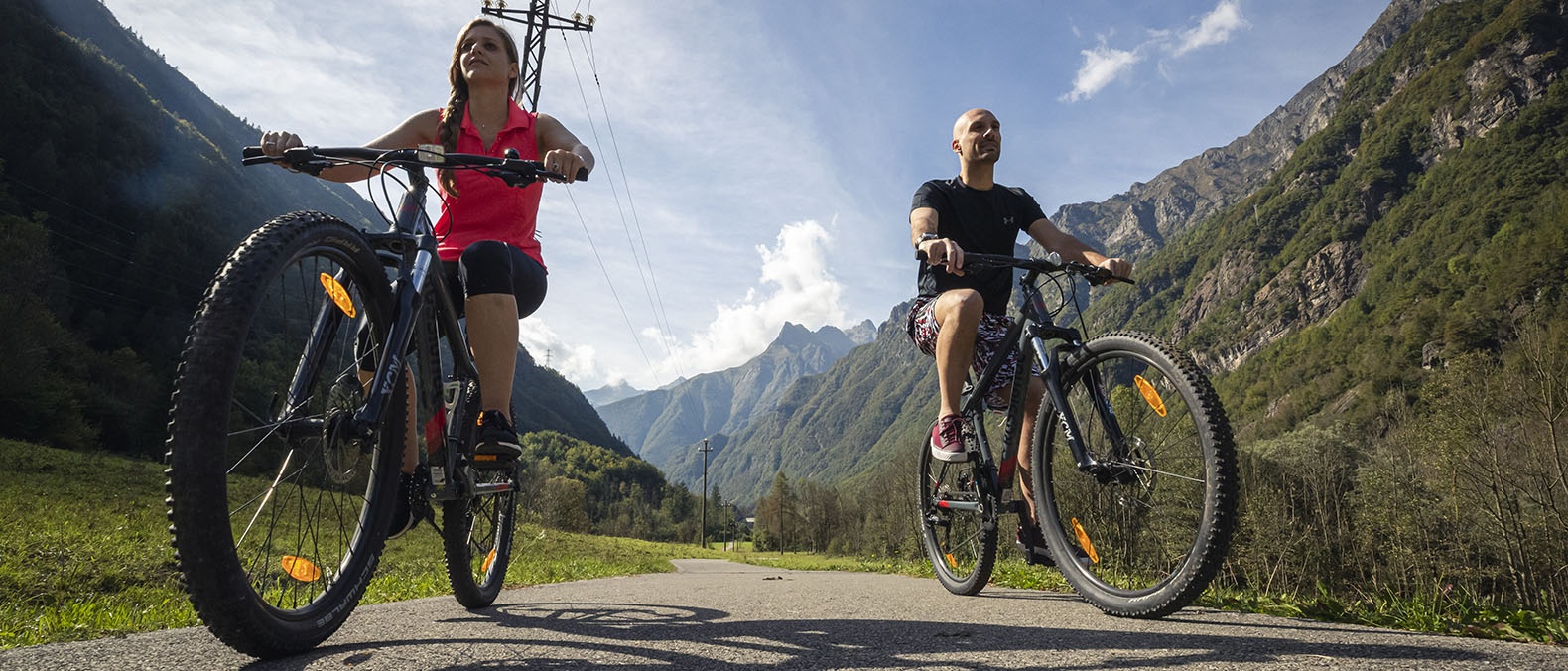
The Seriana Valley cycle path is suitable for all types of bikes, bicycles and road bikes as long as they are equipped with a clincher and gears. It is mostly on a dirt road.
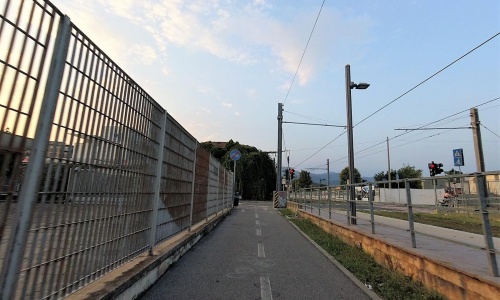
From Bergamo to Albino it runs parallel to and a short distance away from the Seriana Valley tramway. A useful idea for those wishing to shorten the ride and return by tram. Here you can load up to a maximum of 4 bikes per stop.
For those who want to ride the cycle path with their family, we especially recommend two sections: between Ranica and Cene and between Colzate and Clusone, both protected and 100% on the cycle path.
Route information:
Departure point: Bergamo station, piazzale Marconi
Arrival point: Valbondione, via Mes
Travel time: 4-5 hours (one way)
Length: 57km
On cycle path: Bergamo – Ranica 70%; Ranica – Clusone 95%; Clusone – Valbondione 30%.
Ground: asphalt: 70%, dirt: 30%,
Total change in altitude: 850m
Minimum altitude: 249m
Maximum altitude: 874m
Practicability: All year
Suitable for: Adults – the entire cycle path. Adults with children - especially the sections between Ranica and Cene and between Colzate and Clusone.
The Seriana Valley cycle path is the longest cycle path in the province of Bergamo. 60 kilometres surrounded by the valley and alongside the Serio river.
It starts from the centre of Bergamo and ends in Valbondione, at about 900m of altitude.
The track is well signposted and several sections, especially in the lower valley, are illuminated and equipped. Along the way there are several refreshment points, parks, fountains and information boards on the flora and fauna of the area, as well as obviously kilometres and kilometres immersed in nature and history among the Orobic mountains. It is a unique opportunity to relax, do some sport and enjoy the view.
In the first section, the cycle path crosses part of the city centre, therefore the ride is occasionally interrupted by traffic-light controlled pedestrian crossings. From Ranica, on the other hand, the route becomes friendlier and more pleasant, almost always on its own path, it is also suitable for families.
The most challenging section, on the track for 60% of the time, is the part from Clusone to the end of the cycle path in Valbondione. However, it is also the section that offers the most wonderful mountain panoramas.
The Seriana Valley cycle path is suitable for all types of bikes, bicycles and road bikes as long as they are equipped with a clincher and gears. It is mostly on a dirt road.
From Bergamo to Albino it runs parallel to and a short distance away from the Seriana Valley tramway. A useful idea for those wishing to shorten the ride and return by tram. Here you can load up to a maximum of 4 bikes per stop.
For those who want to ride the cycle path with their family, we especially recommend two sections: between Ranica and Cene and between Colzate and Clusone, both protected and 100% on the cycle path.
Route information:
Departure point: Bergamo station, piazzale Marconi
Arrival point: Valbondione, via Mes
Travel time: 4-5 hours (one way)
Length: 57km
On cycle path: Bergamo – Ranica 70%; Ranica – Clusone 95%; Clusone – Valbondione 30%.
Ground: asphalt: 70%, dirt: 30%,
Total change in altitude: 850m
Minimum altitude: 249m
Maximum altitude: 874m
Practicability: All year
Suitable for: Adults – the entire cycle path. Adults with children - especially the sections between Ranica and Cene and between Colzate and Clusone.
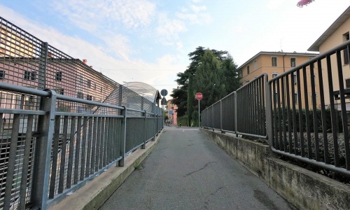
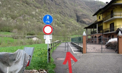
The stretch that connects the city with the Seriana Valley is slightly busy and has several crossings (all assisted by a pedestrian traffic light) but this does not detract from its charm. It crosses quiet areas of the city and the hinterland alongside the Seriana Valley tramway.
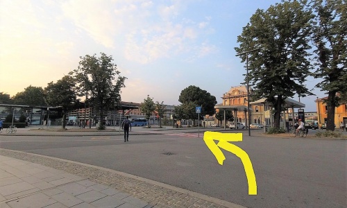
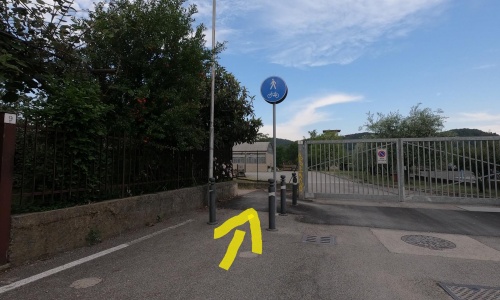
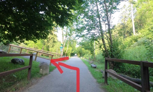
The cycle path starts at the Bergamo train station (piazzale Marconi) where there is also the bus station (pic1). Go right along via Bartolomeo Bono (pic2), at the third roundabout go right (pic3) and after the train tracks go left (pic4) where you ride parallel to the Seriana Valley tram line - TEB. (pic5).
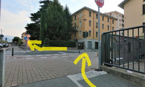
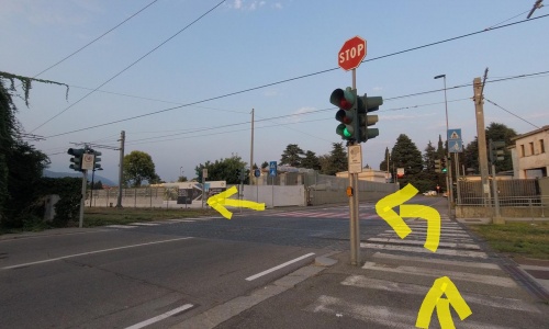
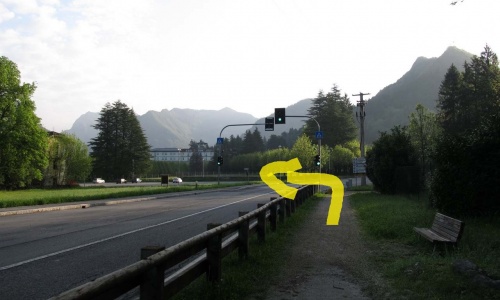
Continue alternating sections to the right and to the left of the railway and crossing two roads with the help of the pedestrian traffic light. (pic6), (pic7), (pic8), (pic9).
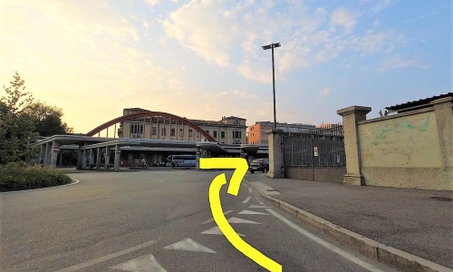
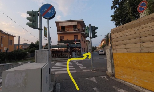
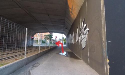
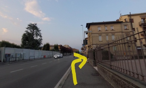
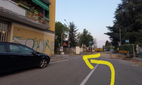
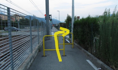
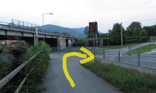
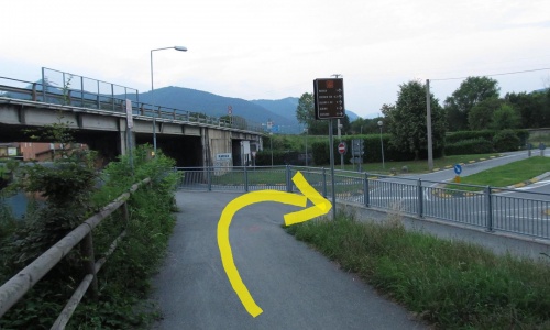
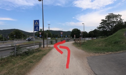
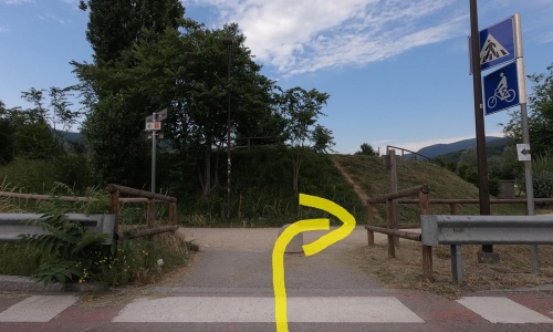
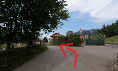
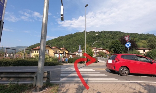
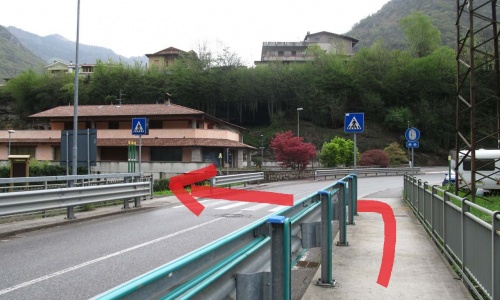
At the third crossing (Via Bianzana) take the small road past the barrier (pic10) and after the underpass go left (pic11); ride 200 metres along a busy road (via Corridoni), at the traffic light go right (pic12) and follow the signs that take you back parallel to the tramway along secondary roads (pic13) (pic14) (pic15).
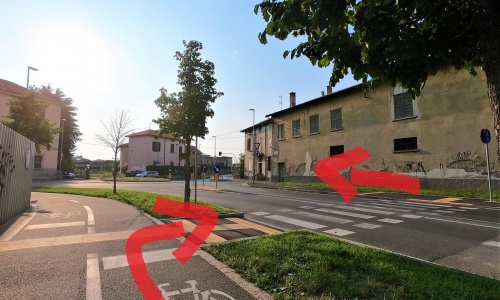
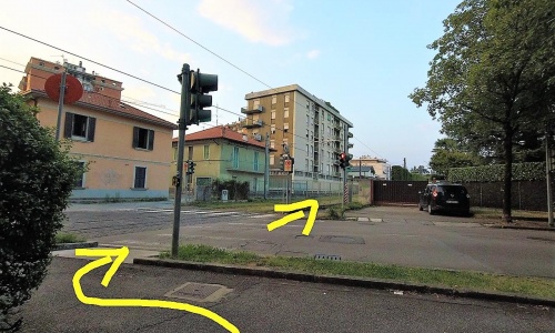
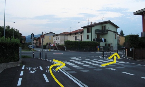
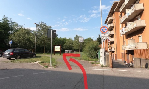
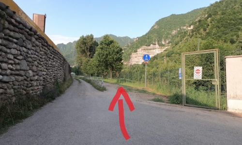
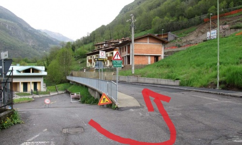
Cross via Martinella (pic16) and arrive at Torre Boldone. Continue past the adventure park and, after going 500 metres parallel to the railway, turn off to the right (directions for Gorle-Ranica) and continue along the cycle path in the industrial area of Torre Boldone (pic17), (pic18), (pic19), (pic20), (pic21), (pic22).
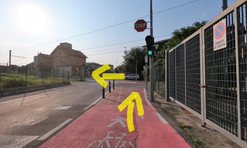
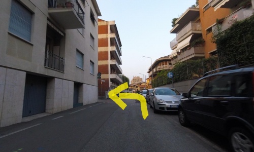
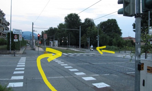
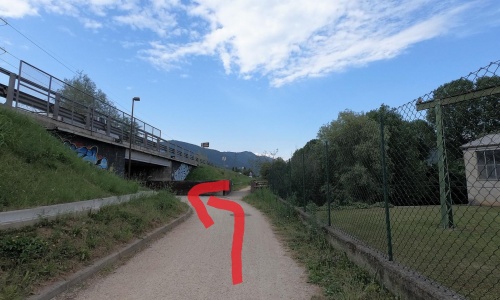
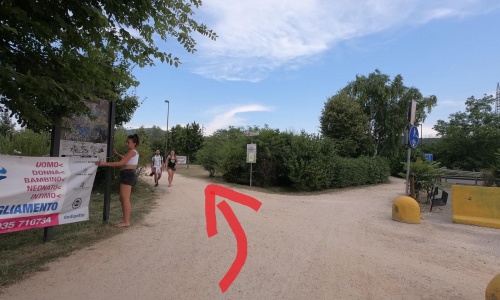
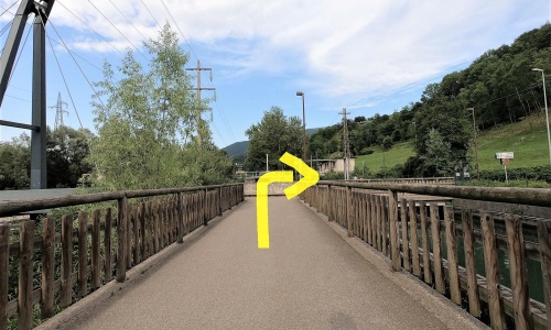
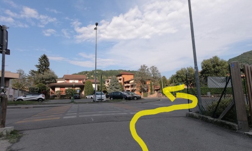
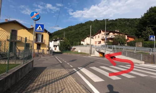
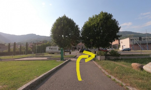
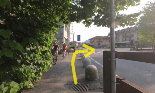
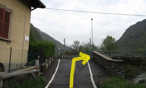
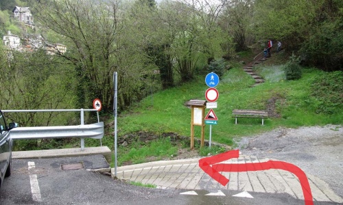
After reaching a large carpark turn left (pic23) on the dirt road and after 300 metres turn right onto the bridge (pic24) where you ride 500 metres of easy white road next to the irrigation canal until you meet the Seriana Valley cycle path Ranica-Clusone (pic25).
The stretch that connects the city with the Seriana Valley is slightly busy and has several crossings (all assisted by a pedestrian traffic light) but this does not detract from its charm. It crosses quiet areas of the city and the hinterland alongside the Seriana Valley tramway.
The cycle path starts at the Bergamo train station (piazzale Marconi) where there is also the bus station (pic1). Go right along via Bartolomeo Bono (pic2), at the third roundabout go right (pic3) and after the train tracks go left (pic4) where you ride parallel to the Seriana Valley tram line - TEB. (pic5).
Continue alternating sections to the right and to the left of the railway and crossing two roads with the help of the pedestrian traffic light. (pic6), (pic7), (pic8), (pic9).
At the third crossing (Via Bianzana) take the small road past the barrier (pic10) and after the underpass go left (pic11); ride 200 metres along a busy road (via Corridoni), at the traffic light go right (pic12) and follow the signs that take you back parallel to the tramway along secondary roads (pic13) (pic14) (pic15).
Cross via Martinella (pic16) and arrive at Torre Boldone. Continue past the adventure park and, after going 500 metres parallel to the railway, turn off to the right (directions for Gorle-Ranica) and continue along the cycle path in the industrial area of Torre Boldone (pic17), (pic18), (pic19), (pic20), (pic21), (pic22).
After reaching a large carpark turn left (pic23) on the dirt road and after 300 metres turn right onto the bridge (pic24) where you ride 500 metres of easy white road next to the irrigation canal until you meet the Seriana Valley cycle path Ranica-Clusone (pic25).


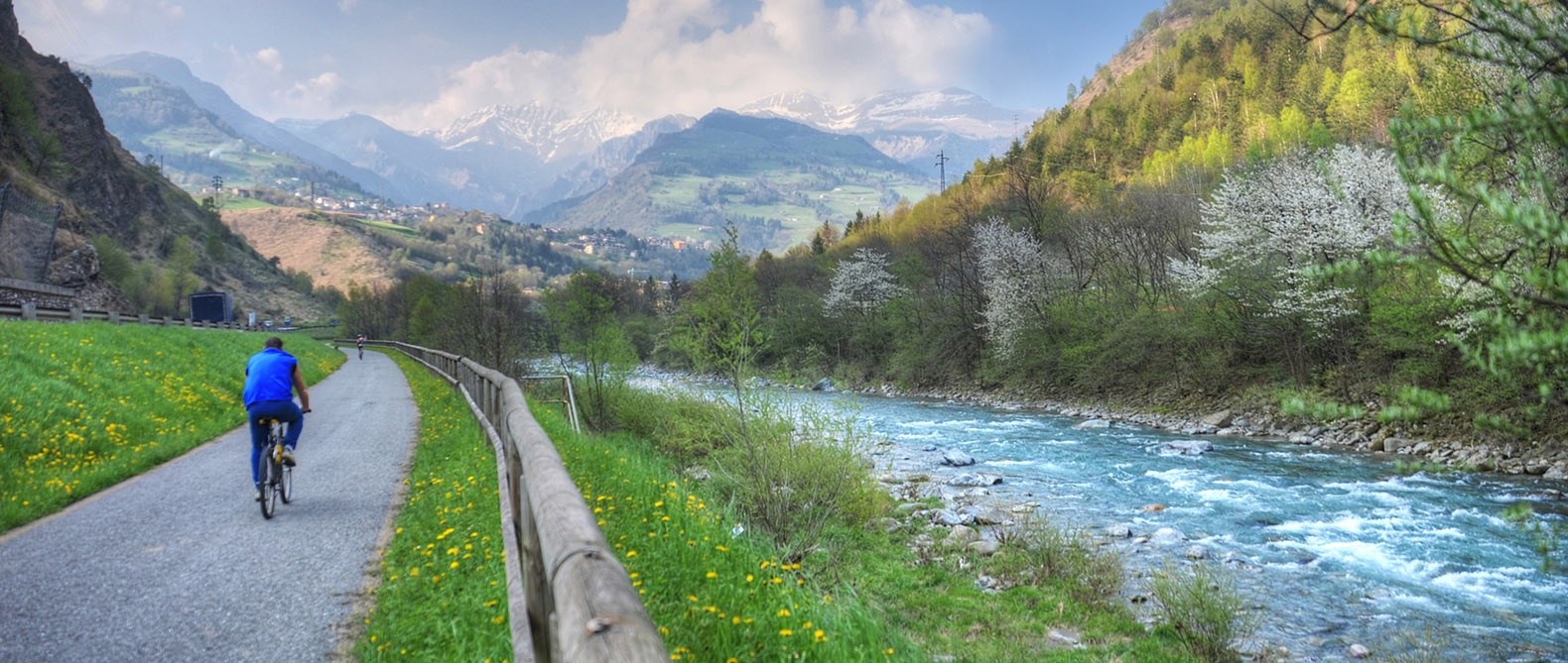
This stretch of cycle path is the easiest. From Ranica to Cene are 17km of uninterrupted cycle path, great for those who want to ride with children. After, there are some short sections on the road.
The path is mostly dirt and alternates between shaded areas and sunny ones. In several sections it retraces the stretch of land that was once the Seriana Valley railway line, which served from 1884 to 1967.
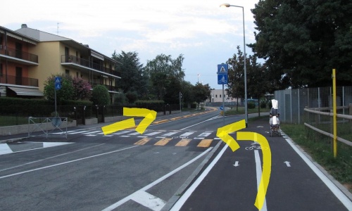
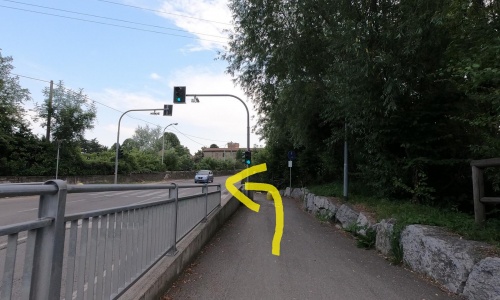
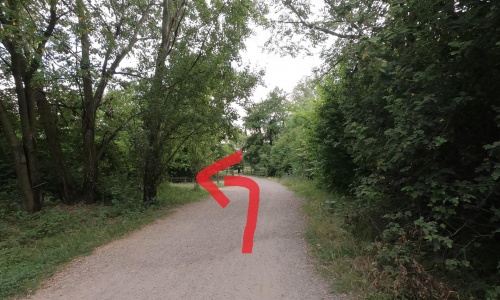
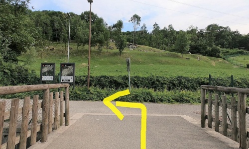
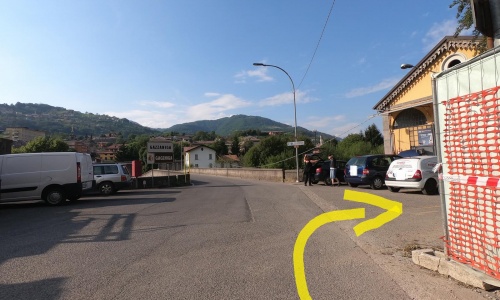
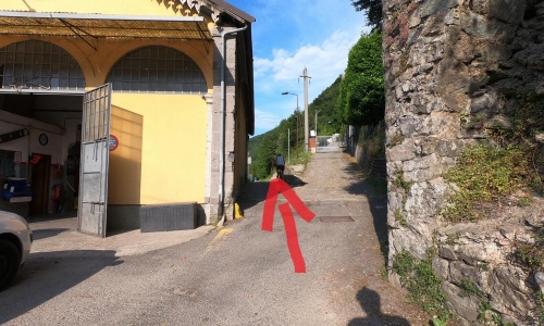
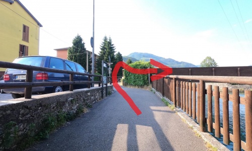
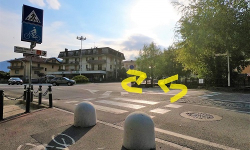
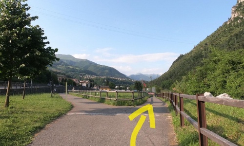
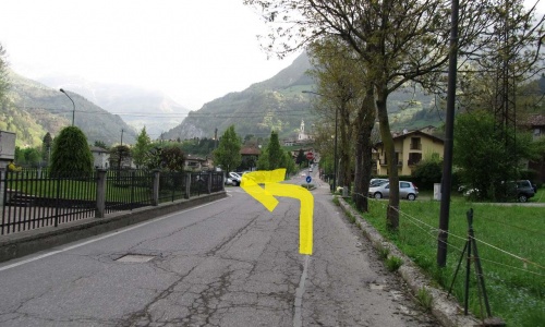
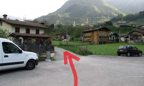
Go down to the right (pic1) and cross the road with the help of the traffic light controlled pedestrian crossing (pic2). After following a short road you will arrive in Via Serio where you see the beginning of the dirt path to your right (pic3) (pic4). Continue on the dirt road and ride over the Alzano Lombardo pedestrian bridge (pic5), (pic6). When you reach Barcicletta go left (pic7) and cross the road, take the right (pic8) and immediately the left (pic9). Ride along the dirt road parallel to the Serio river for about 2 kilometres until the Gavarno bridges (pic10), (pic11).
Here the cycle path divides on both sides. Go to the right (pic12) and continue past the underpass on the left (pic13) (pic14) (pic15). A long dirt road with wide bends follows the course of the river passing through the Alpini park in Pradalunga and after riding over the stone bridge you arrive in Albino where there is a fountain. Cross the road (pic16) and always keep to the main road by the Serio river.
To reach Cene you will find the signs for the cycle path that show you the road (pic17), at the crossroads keep to the right (pic18) (pic19) and ride across the iron bridge. At this point go to the left (pic20) and cross the whole of the Cene park.
Once you get to the Bikegrill refreshment point, go on the road following the indications (pic21) (pic22) (pic23), pass next to a small park and arrive at another crossing.
After this, go to the right and (pic24) follow the road (via Bellora) (pic25) that runs behind some textile companies. Before the bridge turn right (pic26) (pic27), pass a cycle bridge (pic28) and soon you’ll arrive at the Gazzaniga cemetery carpark.
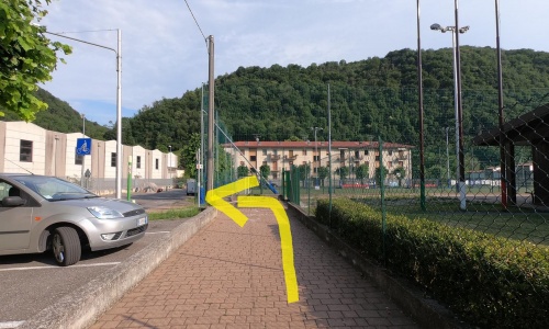
Keep to the right (pic29), the cycle path goes around a soccer field and then continues behind a large industrial building (pic30) (pic31).
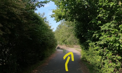
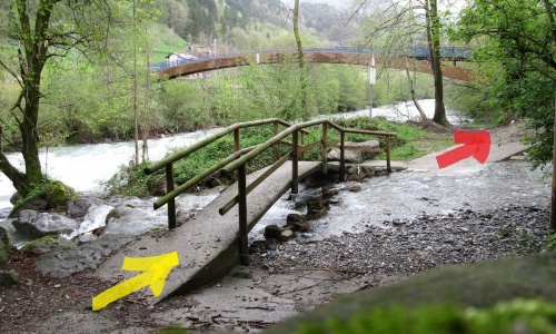
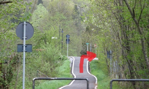
After an old wash-house and two small hairpin bends, you find yourself in the Buschina park (pic32). Cross three bridges and continue to the Vertova park where you keep to the right, pass another bridge and continue to Colzate, where after a descent with hairpin bends, take an underpass and get on the road.
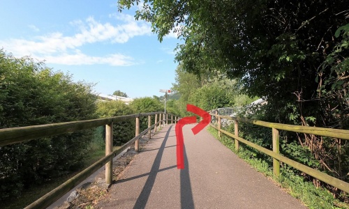
Cross the road, go left (pic33) and ride on the footpath that turns to the right and soon becomes a cycle path (pic34) (pic35).
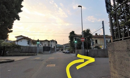
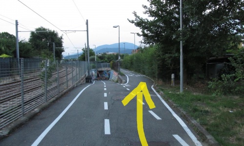
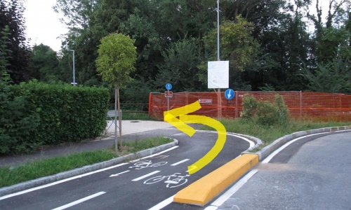
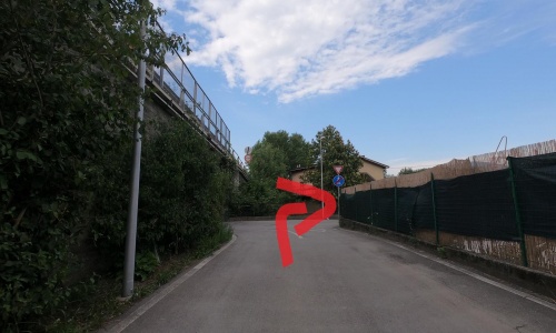
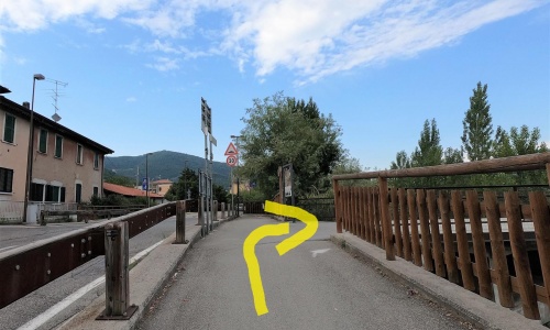
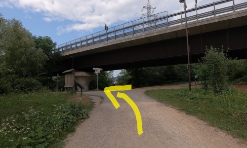
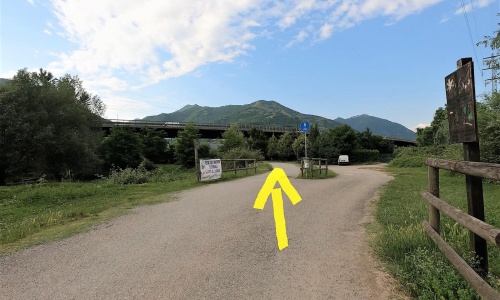
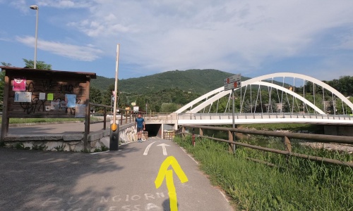
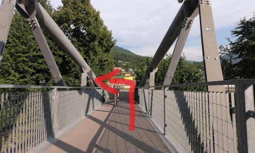
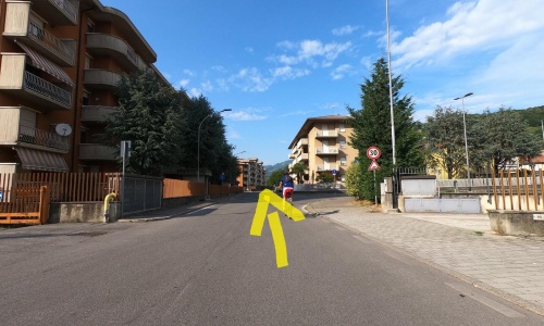
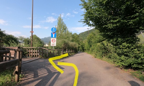
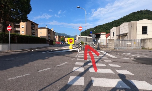
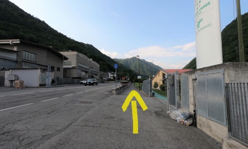
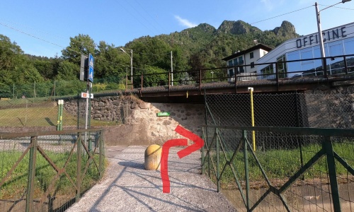
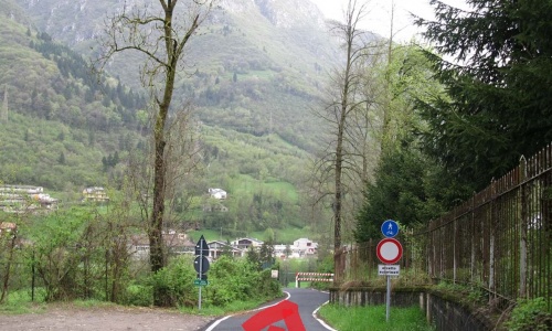
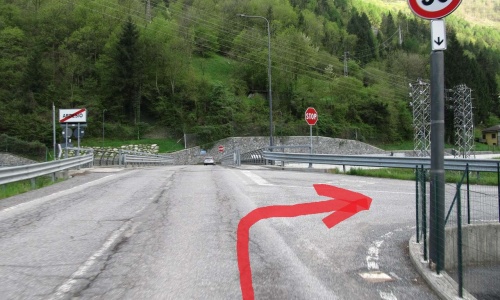
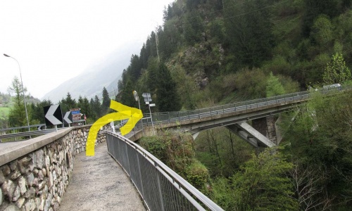
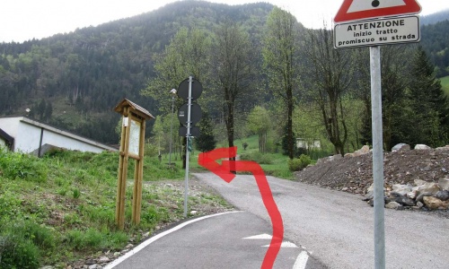
Now continue along the dirt road that from Colzate leads to Ponte Nossa in the shade of the trees (pic36). Shortly before the town, in the sports area, at the crossroads keep to the right (pic37) and go along a narrow stretch of the path near the river. (pic 38) Cross the road and continue on the railway bridge that takes you to the opposite side of the Serio river where the ascent to the Clusone plateau begins (pic39) (pic40) (pic41).
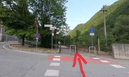
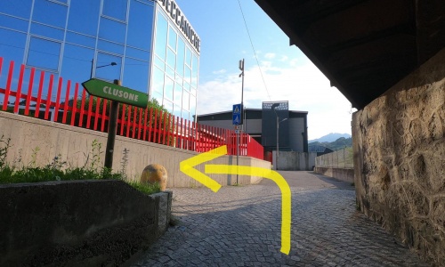
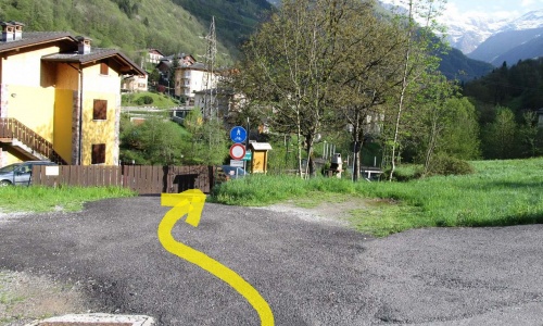
The ascent with a constant 4% gradient gains altitude. It is light and constant because in the past it was travelled by the steam train. After passing an underpass, you will find the beginning of the Upper Seriana Valley cycle path on the left (pic42).
(If you wish, continuing right you arrive at the centre of the town of Clusone).
This stretch of cycle path is the easiest. From Ranica to Cene are 17km of uninterrupted cycle path, great for those who want to ride with children. After, there are some short sections on the road.
The path is mostly dirt and alternates between shaded areas and sunny ones. In several sections it retraces the stretch of land that was once the Seriana Valley railway line, which served from 1884 to 1967.
Go down to the right (pic1) and cross the road with the help of the traffic light controlled pedestrian crossing (pic2). After following a short road you will arrive in Via Serio where you see the beginning of the dirt path to your right (pic3) (pic4). Continue on the dirt road and ride over the Alzano Lombardo pedestrian bridge (pic5), (pic6). When you reach Barcicletta go left (pic7) and cross the road, take the right (pic8) and immediately the left (pic9). Ride along the dirt road parallel to the Serio river for about 2 kilometres until the Gavarno bridges (pic10), (pic11).
Here the cycle path divides on both sides. Go to the right (pic12) and continue past the underpass on the left (pic13) (pic14) (pic15). A long dirt road with wide bends follows the course of the river passing through the Alpini park in Pradalunga and after riding over the stone bridge you arrive in Albino where there is a fountain. Cross the road (pic16) and always keep to the main road by the Serio river.
To reach Cene you will find the signs for the cycle path that show you the road (pic17), at the crossroads keep to the right (pic18) (pic19) and ride across the iron bridge. At this point go to the left (pic20) and cross the whole of the Cene park.
Once you get to the Bikegrill refreshment point, go on the road following the indications (pic21) (pic22) (pic23), pass next to a small park and arrive at another crossing.
After this, go to the right and (pic24) follow the road (via Bellora) (pic25) that runs behind some textile companies. Before the bridge turn right (pic26) (pic27), pass a cycle bridge (pic28) and soon you’ll arrive at the Gazzaniga cemetery carpark.
Keep to the right (pic29), the cycle path goes around a soccer field and then continues behind a large industrial building (pic30) (pic31).
After an old wash-house and two small hairpin bends, you find yourself in the Buschina park (pic32). Cross three bridges and continue to the Vertova park where you keep to the right, pass another bridge and continue to Colzate, where after a descent with hairpin bends, take an underpass and get on the road.
Cross the road, go left (pic33) and ride on the footpath that turns to the right and soon becomes a cycle path (pic34) (pic35).
Now continue along the dirt road that from Colzate leads to Ponte Nossa in the shade of the trees (pic36). Shortly before the town, in the sports area, at the crossroads keep to the right (pic37) and go along a narrow stretch of the path near the river. (pic 38) Cross the road and continue on the railway bridge that takes you to the opposite side of the Serio river where the ascent to the Clusone plateau begins (pic39) (pic40) (pic41).
The ascent with a constant 4% gradient gains altitude. It is light and constant because in the past it was travelled by the steam train. After passing an underpass, you will find the beginning of the Upper Seriana Valley cycle path on the left (pic42).
(If you wish, continuing right you arrive at the centre of the town of Clusone).
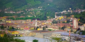
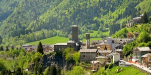
Situated at the beginning of the Seriana Valley, this town is the first stop in a tour of art and history along the course of the River Serio.
The old part of the town is centred around the Basilica of San Martino with its famous sacristies.
Another town of great artistic and architectural value is Gandino, with the basilica of Santa Maria Assunta, the Basilica Museum and its textile section, which, together with the Textile Museum of Leffe, testify to an activity that for centuries has characterised the economy of the valley.
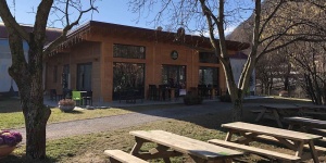
Barcicletta is located in Alzano Lombardo, next to the Seriana Valley cycle path that leads to Clusone. Made from wood and using the philosophy of recovery, without however, lacking originality and functionality. Everything is designed to give visitors a welcoming place where they can stop and relax in a modern and dynamic environment.
Barcicletta offers cold and hot dishes for lunch and dinner, alcoholic and non-alcoholic beverages and snacks during the day and a hearty breakfast in the morning. At any time of day, the restaurant is at the customer's service.
Located in Cene, on the Seriana Valley cycle path, a few km from the centre of Clusone and 20 km from Bergamo Airport, Cene's Chalet offers its visitors themed degustation evenings with live music and events related to the biking world such as Sunday bike rides.
The restaurant is open at noon and for dinner and is an excellent starting point for a bike ride along the cycle path, to reach and visit Clusone or to discover the nearby Vertova Valley, a place of unpolluted natural beauty, with its azure waterfalls in the woods.
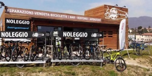
Chalet also offers rental bikes and if instead you bring your own but you’re having some problems, Bike Grill has a bike workshop that will have it fixed again in no time.
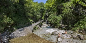
This natural jewel of Seriana Valley takes up almost 12 km among the mounts Cavlera, Suchello and Alben.
Cars are not allowed here: if you want to explore the heart of Vertova Valley you will have to walk along mule tracks and pathways. But don’t worry: the main trail is very easy! It is also extremely charming, as well: it goes along the creek that creates numerous small waterfalls and shiny natural pools carved in the dolomitic rocks, called “marmitte dei giganti”.
The Valley also features a lush vegetation, with ash trees, maples, beech trees and fruit trees such as chestnuts. What are you waiting for? Pack your rucksack and go!
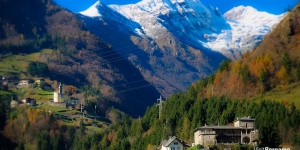
The mountains all around Clusone give it its stunning beauty.
The sunny highland where it is located is the perfect place to enjoy the forests of the Orobie Mountains surrounding the village, to start a walk towards the Presolana Massif, or even to reach the numerous ski resorts of the valley.
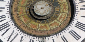
Instead, strolling across its streets is the best way to admire the fantastic frescos decorating the most significant buildings of the village, such as the Town Hall or the Clock Tower. Some of them are truly outstanding, like the cycle dedicated to Death at the Disciplini Oratory: observe it carefully, it’s the best-preserved one in Europe!

The last stretch of cycle path changes its appearance completely. It is totally paved, has several stretches on the road and has a couple of short but fairly demanding ascents. However, the scenery along the route is remarkable. The landscape is mountainous. It is in the heart of the eastern Bergamo Orobie.
You will pass through villages with stone houses and slate roofs and will ride in the shade of thick pine forests. An enchanting high-mountain cycle path to be done calmly to enjoy the views and places you pass.
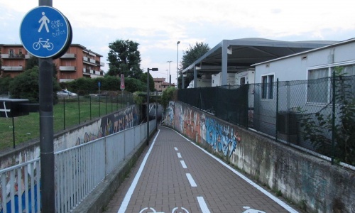
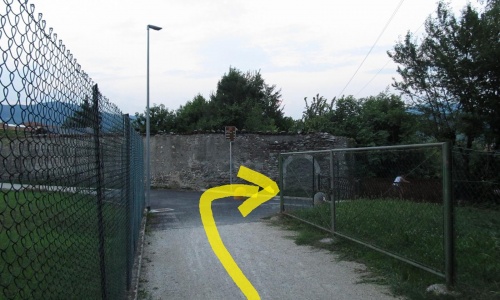
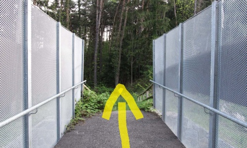
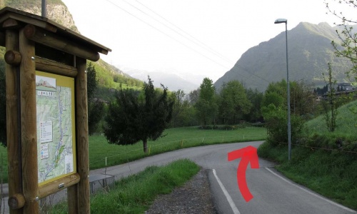
After the underpass, go left (pic1) and enter a maze of paved paths in the pine forest used for roller skiing. Keep to the main road going up and cross the bridge (pic2) that crosses the provincial road. Continue in the Clusone pine forest towards Piario - Groppino.
When you reach the hospital, cross the road (pic3) and descend towards the bank of the Serio river (pic4) to briefly flank it. Continue to the edge of meadows and finally reach the houses of Villa d’Ogna (pic5) where the cycle path crosses the Serio river twice (pic6) (pic7) and finally continues (pic8) and goes up the road (pic9).
Now stay on Via Cunella for about 2 kilometres, a stretch with little traffic that arrives at the town of Ardesio. At the stop sign, continue along the cycle path (pic10) (pic11) that runs parallel to the Serio river just below the town (pic12) (pic13) and then up again on the road to Ponte Seghe. From here you have to ride along 3km of provincial road to the village of Gromo.
Once in Gromo, we recommend a short detour into the village. Gromo is a historic feudal centre of high historical interest, recognised both as one of the "Most Beautiful Villages of Italy" and as the orange flag of the Italian Touring Club.
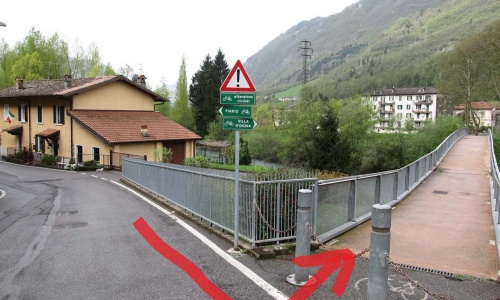
Under the spur of the Gromo castle, turn right and follow the signs for Spiazzi di Gromo (pic14). After the bridge, turn left (pic15) where a beautiful stretch of path begins with ups and downs in the pine forest that runs alongside the river. Here you come across the first short, but rather hard ascent (pic16). However, the effort will be amply rewarded by the exceptional panoramic views offered by this high point of the cycle path.
Soon you reach the town of Gandellino (pic17) which you ride through and then take the cycle path again (pic18) that runs alongside a hydroelectric plant and the Serio rapids. When you cross the road again go to the right (pic19) and enter the centre of Gromo San Marino. Continue your ride, keeping the Serio river on your left, along the road to the village of Pietra and then back on the cycle path (pic20) where you come across the second short ascent with hairpin bends that enters the woods and arrives at Fiumenero, which is on the opposite shore of the Serio. This stretch in the woods is very characteristic with its numerous streams and the beautiful alpine vegetation.
Now all you have to do is continue straight on the cycle path, passing pine forests and hydroelectric power stations, bridges over streams and crystalline lakes. After just under 4km you come to the Valbondione campsites and soon to the centre of the village.
For the more daring and fit you can continue further and reach the Curò and Barbellino mountain refuges on foot or by mountain bike.
The last stretch of cycle path changes its appearance completely. It is totally paved, has several stretches on the road and has a couple of short but fairly demanding ascents. However, the scenery along the route is remarkable. The landscape is mountainous. It is in the heart of the eastern Bergamo Orobie.
You will pass through villages with stone houses and slate roofs and will ride in the shade of thick pine forests. An enchanting high-mountain cycle path to be done calmly to enjoy the views and places you pass.
After the underpass, go left (pic1) and enter a maze of paved paths in the pine forest used for roller skiing. Keep to the main road going up and cross the bridge (pic2) that crosses the provincial road. Continue in the Clusone pine forest towards Piario - Groppino.
When you reach the hospital, cross the road (pic3) and descend towards the bank of the Serio river (pic4) to briefly flank it. Continue to the edge of meadows and finally reach the houses of Villa d’Ogna (pic5) where the cycle path crosses the Serio river twice (pic6) (pic7) and finally continues (pic8) and goes up the road (pic9).
Now stay on Via Cunella for about 2 kilometres, a stretch with little traffic that arrives at the town of Ardesio. At the stop sign, continue along the cycle path (pic10) (pic11) that runs parallel to the Serio river just below the town (pic12) (pic13) and then up again on the road to Ponte Seghe. From here you have to ride along 3km of provincial road to the village of Gromo.
Once in Gromo, we recommend a short detour into the village. Gromo is a historic feudal centre of high historical interest, recognised both as one of the "Most Beautiful Villages of Italy" and as the orange flag of the Italian Touring Club.
Under the spur of the Gromo castle, turn right and follow the signs for Spiazzi di Gromo (pic14). After the bridge, turn left (pic15) where a beautiful stretch of path begins with ups and downs in the pine forest that runs alongside the river. Here you come across the first short, but rather hard ascent (pic16). However, the effort will be amply rewarded by the exceptional panoramic views offered by this high point of the cycle path.
Soon you reach the town of Gandellino (pic17) which you ride through and then take the cycle path again (pic18) that runs alongside a hydroelectric plant and the Serio rapids. When you cross the road again go to the right (pic19) and enter the centre of Gromo San Marino. Continue your ride, keeping the Serio river on your left, along the road to the village of Pietra and then back on the cycle path (pic20) where you come across the second short ascent with hairpin bends that enters the woods and arrives at Fiumenero, which is on the opposite shore of the Serio. This stretch in the woods is very characteristic with its numerous streams and the beautiful alpine vegetation.
Now all you have to do is continue straight on the cycle path, passing pine forests and hydroelectric power stations, bridges over streams and crystalline lakes. After just under 4km you come to the Valbondione campsites and soon to the centre of the village.
For the more daring and fit you can continue further and reach the Curò and Barbellino mountain refuges on foot or by mountain bike.
Going up the Seriana Valley, you will find a dark cliff along the street. Gromo is right over there: one of Italy’s most beautiful hamlets.
Go walk across its medieval alleys, and it will be like going back in time. You could even find a smith hammering at his anvil: in fact, during the Middle Age smithies were so numerous here that Gromo started to be called “The little Toledo”, a city renowned for the white weapons manufacture.
Go visit the lovely Museum of White Weapons and Parchments (“Museo delle Armi Bianche e Pergamene”), inside Palazzo Milesi, and discover the beautiful armours and weapons displayed.
Pure white snow, vivid green vegetation, blue sky: these are the colours that characterise this ski resort, which developed in the heart of a large, dense forest of tall trees, on the edge of which lies a medieval village with a new development of houses and comfortable hotels.
Gromo-Spiazzi, however, is more than just a ski resort; it is also a place where you can spend a quiet and relaxing holiday. One of the most beautiful and best-preserved old villages in the province of Bergamo, it also offers rare examples of historic art and exceptional food in the local restaurants.
HOW TO GET THERE
From Bergamo, take the Valle Seriana provincial road until Gromo, then turn right for Boario and continue until Spiazzi (46 km). The resort is 96 km from Milan. The resort is served by bus from Bergamo.
Ski lifts: 5
Pistes: 8
Level: 2 easy - 4 intermediate - 2 difficult
Km of pistes: 15
Snow cannons: low pressure system on all of the pistes
Cross-country ski trail: 7,5 km
Facilities: outdoor natural ice-skating rink, 1,000 m toboggan run
Tourist Office: +39 0346 47345
Ski lifts: +39 0346 47079