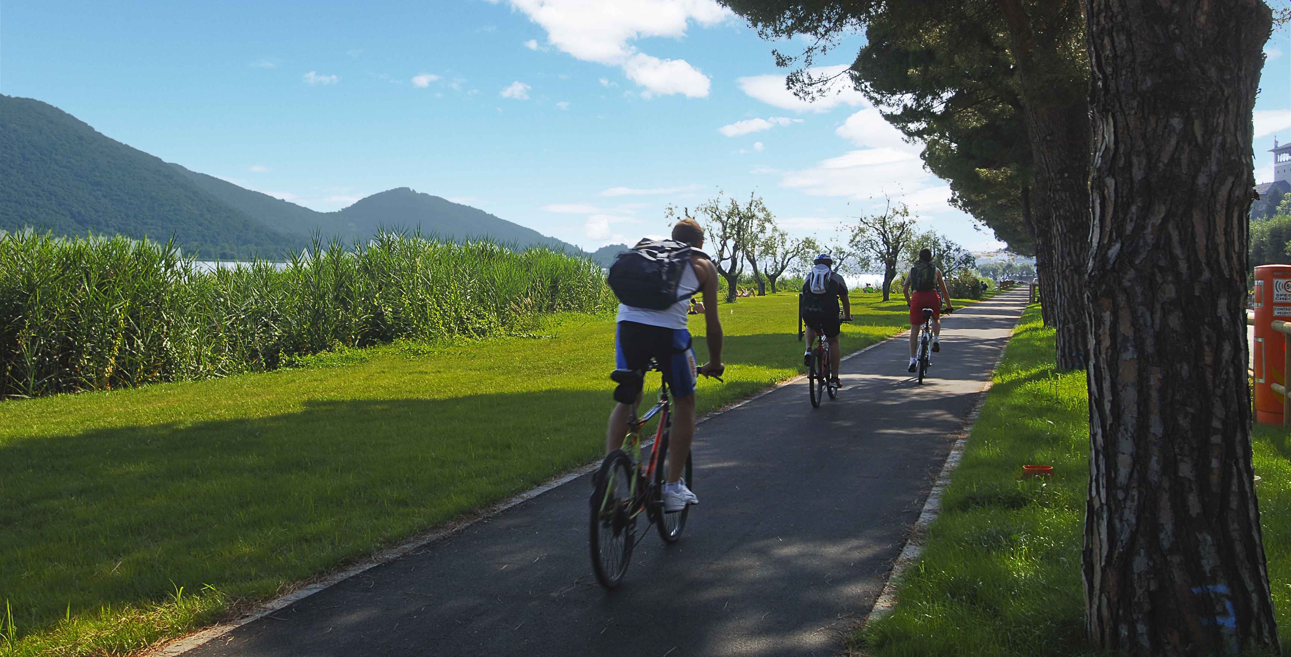
The North-East Lakes cycle path is almost 40km long. From Bergamo, it crosses the hills and vineyards of the Calepio Valley and reaches Sarnico, a town nestled on Lake Iseo.
The cycle route is almost entirely on asphalt, only some stretches are on dirt roads. For a few hundred metres the proposed route requires you to ride on state highway 42 and provincial road 91. These are roads that cars use to reach Lake Iseo. Apart from these few hundred metres, the cycle path is on secondary roads in residential and industrial areas and on dirt roads in the fields, in the middle of nature. On your way to Lake Iseo you will pass through Valcalepio’s vineyards, a territory where the eponymous wine is produced, both red and white DOC.
Along the way, there is only one challenging ascent, in the Castelli Calepio area, where the cycle path descends towards the bed of the Oglio river and then goes up again.
Departing from Bergamo Station, after a short stretch in the city, continue towards the nearby town of Seriate, where sections road and cycle path alternate.
Instead, in the area between Bagnatica and Castelli Calepio, in addition to some road crossings, there are also dirt tracks in the meadows to reach the Oglio cycle path. Here you will go along the river for a few kilometres and reach the end of the itinerary, at Sarnico.
Once in Sarnico, for the fit riders we suggest two options:
1) circumnavigating Lake Iseo (about 67km), observing how much the landscape changes from the lower lake, with lively towns, to the upper lake, towards the Orobie Prealps, therefore greener, quieter and with more sections immersed in nature.
2) From Sarnico go by bike to Sulzano (it's about 16km), a town on the lake in the province of Brescia. Take the bike on the ferry and disembark at Monte Isola and go around this wonderful lake island, the largest in Europe.
Route information:
Departure point: Bergamo station, piazzale Marconi
Arrival point: Sarnico, piazza XX Settembre
Travel time: 3 hours (one way)
Length: 38km
Type of path: cycle path 15%, agricultural roads 15%, low-traffic road 50%, medium-high traffic road 20%
Ground: asphalt: 80%, dirt: 20%,
Total change in altitude: 350m
Minimum altitude: 164m
Maximum altitude: 265m
Practicability: All year
Suitable for: Adults with a small amount of training and lovers of
cycle-hiking tourism.
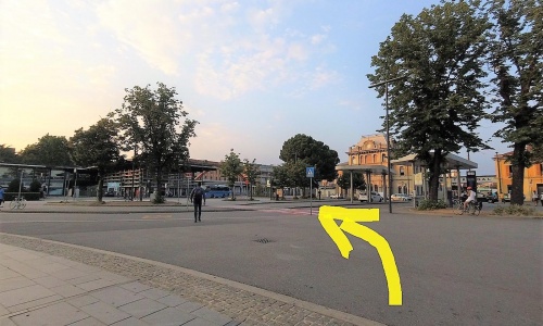
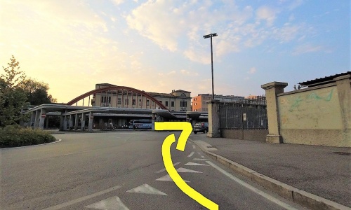
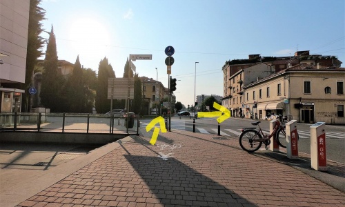
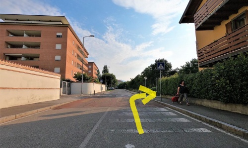

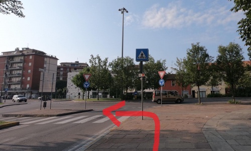
Departure is from Bergamo station. Take the path near the Seriana Valley tram stop (pic1) (pic2) (pic3) (pic4) and follow it to Borgo Palazzo.
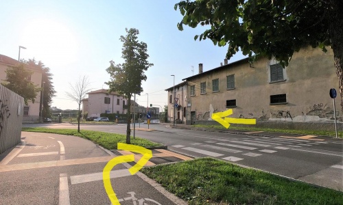
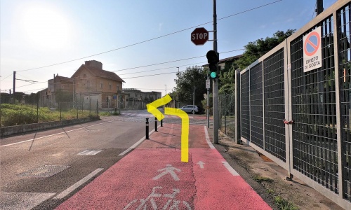
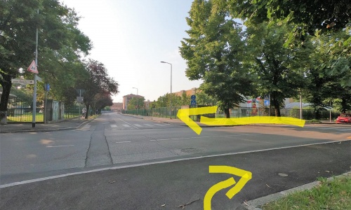
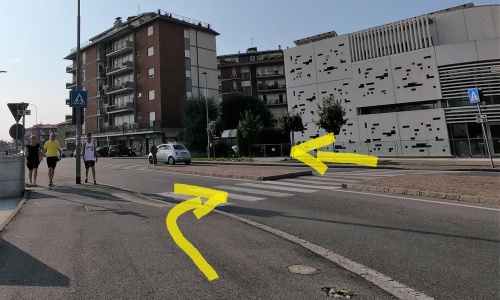
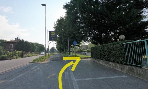
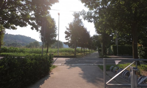
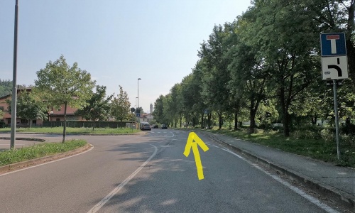
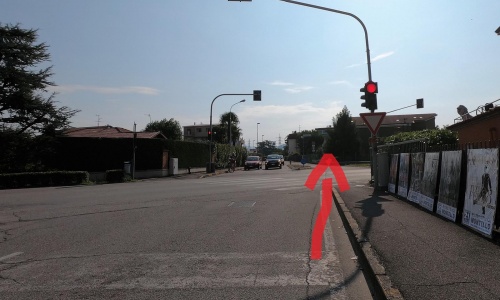
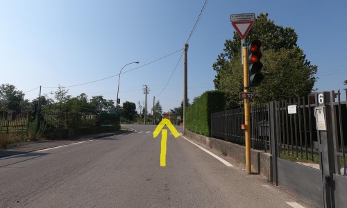
Along via Borgo Palazzo (pic5) the path is on the sidewalk. At the traffic light the path crosses Viale Pirovano (the street leading to the monumental cemetery) and changes side of the road (pic6). After a few metres pass the Borgo Palazzo viaduct (pic7) (pic8) and, proceeding straight ahead, you’ll arrive at the traffic light where the Hotel Post is in Celadina. Turn left onto via Spalenga (pic9) and then take the right (pic10) and ride on internal streets between the houses, an area that is certainly quieter than the official cycle lane that runs straight on the arterial road SS42 (pic11) (pic12) (pic13) (pic14) (pic15) (pic16) (pic17) (pic18) (pic19) (pic20) (pic21).
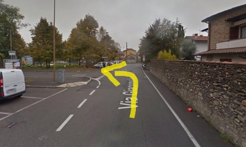
At the intersection with Via Cerioli in Seriate, continue straight on the bridge that crosses the Serio river (pic22), go right (pic23) then immediately left (pic24) and pass by the houses along via Adamello (pic25). At the roundabout turn right, pedalling next to Seriate’s cemetery (pic26) to the next roundabout where you go to the left (pic27) (pic28) again taking the SS42 for 400m before taking the underpass (pic29).
Departure is from Bergamo station. Take the path near the Seriana Valley tram stop (pic1) (pic2) (pic3) (pic4) and follow it to Borgo Palazzo.
Along via Borgo Palazzo (pic5) the path is on the sidewalk. At the traffic light the path crosses Viale Pirovano (the street leading to the monumental cemetery) and changes side of the road (pic6). After a few metres pass the Borgo Palazzo viaduct (pic7) (pic8) and, proceeding straight ahead, you’ll arrive at the traffic light where the Hotel Post is in Celadina. Turn left onto via Spalenga (pic9) and then take the right (pic10) and ride on internal streets between the houses, an area that is certainly quieter than the official cycle lane that runs straight on the arterial road SS42 (pic11) (pic12) (pic13) (pic14) (pic15) (pic16) (pic17) (pic18) (pic19) (pic20) (pic21).
At the intersection with Via Cerioli in Seriate, continue straight on the bridge that crosses the Serio river (pic22), go right (pic23) then immediately left (pic24) and pass by the houses along via Adamello (pic25). At the roundabout turn right, pedalling next to Seriate’s cemetery (pic26) to the next roundabout where you go to the left (pic27) (pic28) again taking the SS42 for 400m before taking the underpass (pic29).
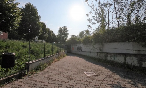
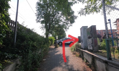
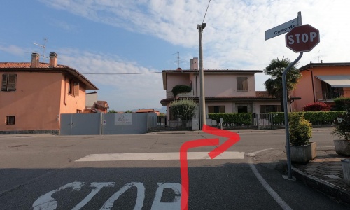
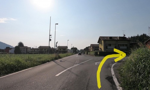
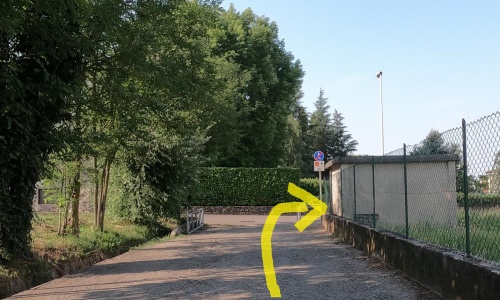
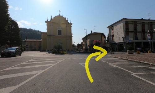
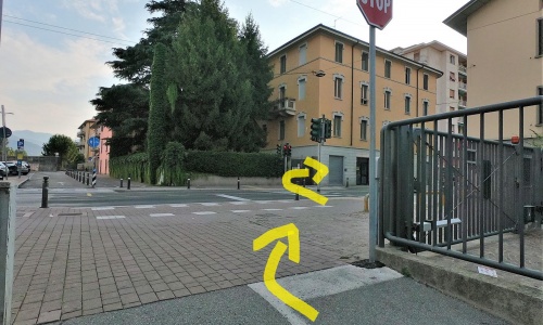
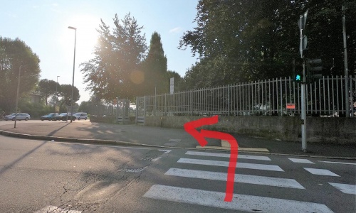
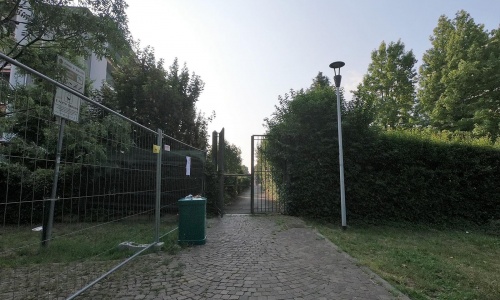
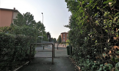
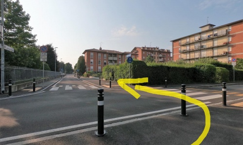
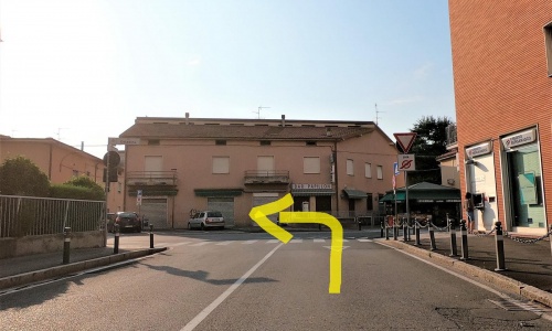
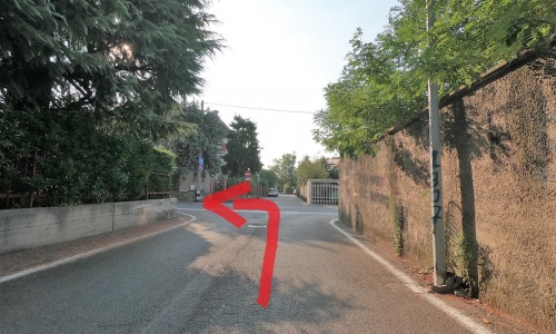
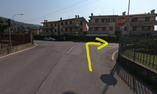
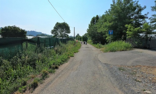
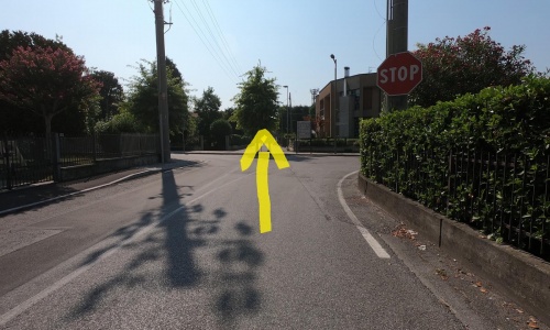
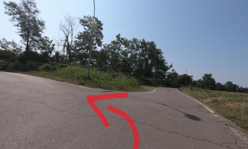
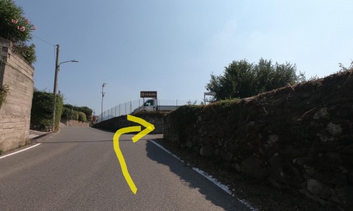
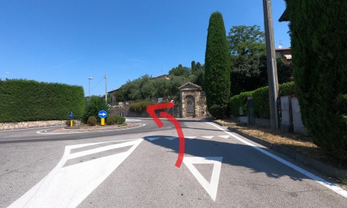
Enter the railway underpass (pic30) and continue to the right (pic31) take the left (pic32) after 200 metres onto a dirt road between the cultivated fields that leads to the town of Comonte (pic33). At the stop sign go left (pic34), pass the roundabout (pic35) and at the next stop take the right (pic36) on the quiet via Comonte. At the umpteenth stop sign, go to the right (pic37) on the overpass and just before the roundabout take the bike lane to the left (pic38) (pic39): you are now in the municipality of Brusaporto. Here the path passes first in a small cool wood, then next to large cultivated meadows, some with vineyards and others with grain. The path has some gentle ups and downs. After passing the stretch in the woods, at the junction where there is a small pond and a fountain, take the left (pic40). After a bit more pedalling, you pass a road crossing (pic41). Continue on the path until, now in Bagnatica, you get to the road (pic42). At the stop sign go left and take via Belvedere (pic43), at the end of which you take the left again (pic44) and then immediately the right. You are in front of the church of San Giovanni Battista in Bagnatica. Take the right (pic45) and, at the traffic lights, the left (pic46). After 800 metres you will get to Costa di Mezzate (pic47).
Enter the railway underpass (pic30) and continue to the right (pic31) take the left (pic32) after 200 metres onto a dirt road between the cultivated fields that leads to the town of Comonte (pic33). At the stop sign go left (pic34), pass the roundabout (pic35) and at the next stop take the right (pic36) on the quiet via Comonte. At the umpteenth stop sign, go to the right (pic37) on the overpass and just before the roundabout take the bike lane to the left (pic38) (pic39): you are now in the municipality of Brusaporto. Here the path passes first in a small cool wood, then next to large cultivated meadows, some with vineyards and others with grain. The path has some gentle ups and downs. After passing the stretch in the woods, at the junction where there is a small pond and a fountain, take the left (pic40). After a bit more pedalling, you pass a road crossing (pic41). Continue on the path until, now in Bagnatica, you get to the road (pic42). At the stop sign go left and take via Belvedere (pic43), at the end of which you take the left again (pic44) and then immediately the right. You are in front of the church of San Giovanni Battista in Bagnatica. Take the right (pic45) and, at the traffic lights, the left (pic46). After 800 metres you will get to Costa di Mezzate (pic47).
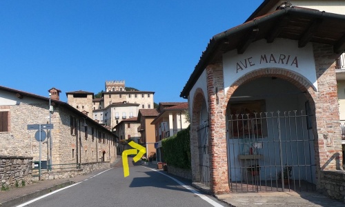
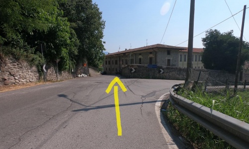
Follow the signs that lead you to the centre of the town of Costa di Mezzate, where you will see a majestic castle dominating above you (pic48) (pic49). Ride along Via Giovanni Battista Camozzi: for a few metres you will be going against the direction of traffic, so we suggest you get off the bike and accompany it by hand. When you reach the stop sign, turn left (pic50), get back on and go along a small road that goes into the countryside in the shade of the plants (via Foppe).
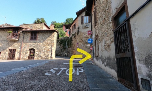
At the crossroads keep to the main road on the left (pic51) and on the next keep to the right (pic52) (pic53) until you cross via Colleoni where you go to the right (pic54) in the historic street between old houses, also against the direction of traffic: get off the bike for these last few metres.
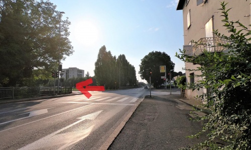
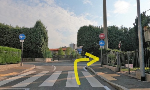
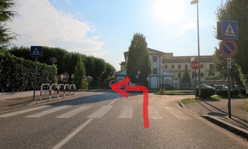
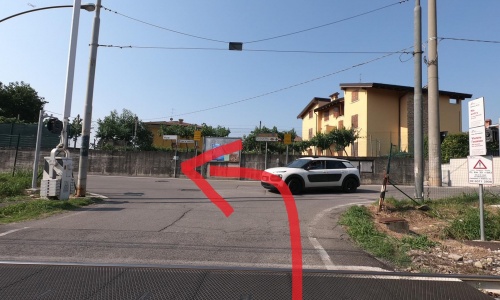
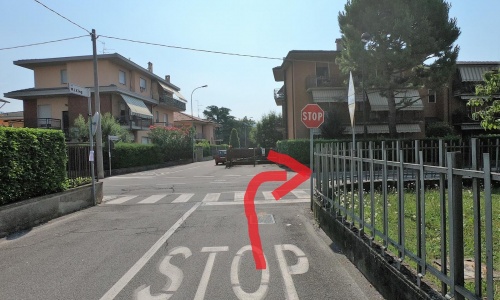
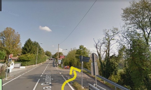
When you reach the bridge over the Zerra torrent, continue straight along Via Brevi (pic55), cross the train tracks and go to the right (pic56) towards the Montello-Gorlago station, beyond which you arrive at the traffic light that crosses the SP91 leading to Sarnico.
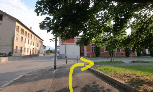
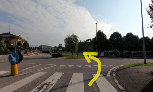
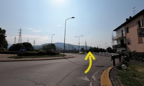
Continue straight (pic57) and at the roundabout turn right towards Carobbio degli Angeli(pic58) keep to the main road using the short cycle path behind the power plant. Cross the bridge over the Cherio river (a branch of Lake Endine) and enter the municipality of Carobbio degli Angeli. After 200 metres turn right (pic59) towards the parish of Cicola and arrive at the traffic light further on (pic60).
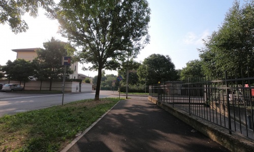
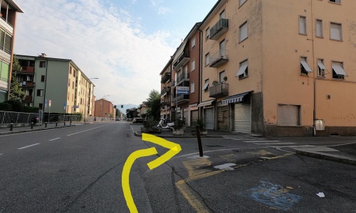
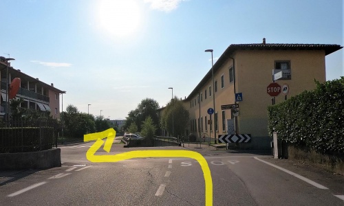
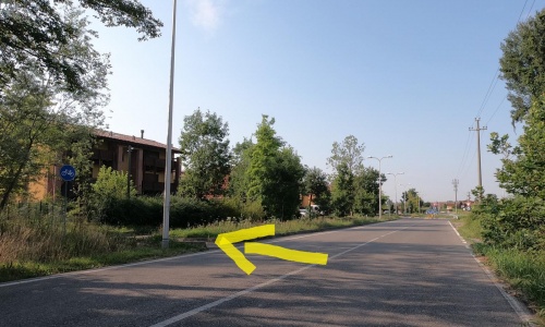
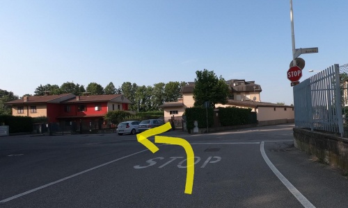
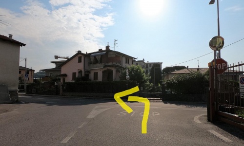
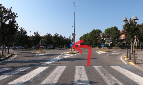
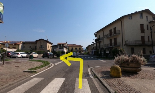
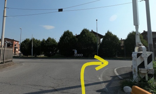
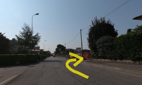
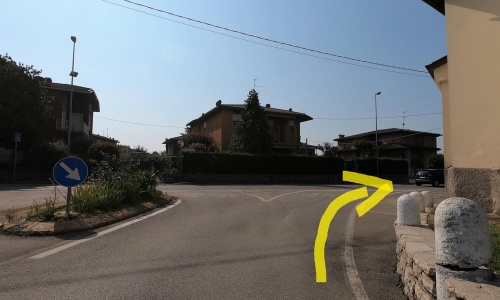
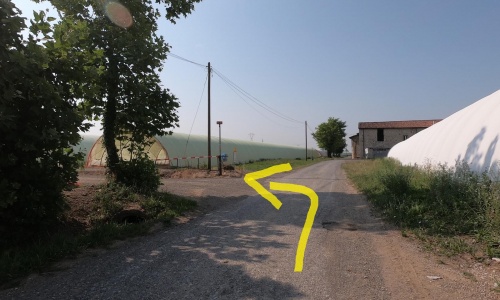
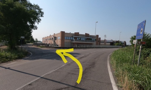
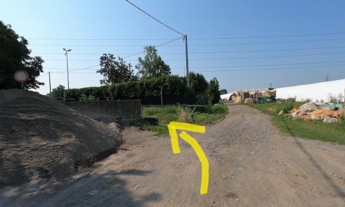
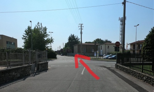
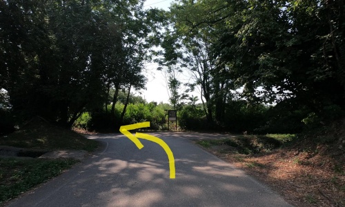
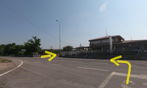
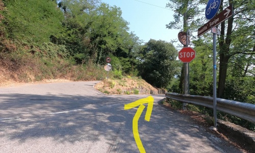
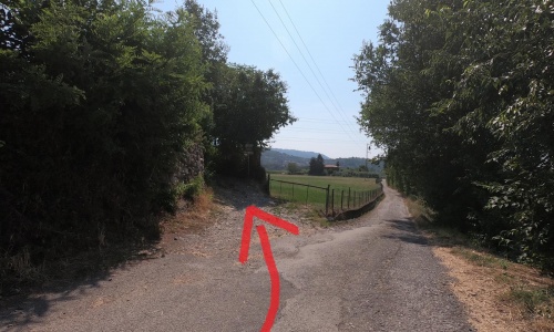
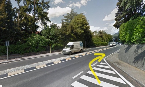
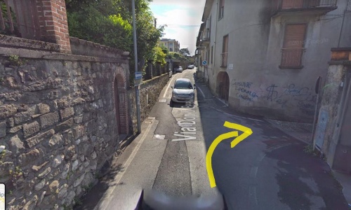
Cross back over the SP91 (pic61) and the railway, go left (pic62) and take a quiet dirt road among meadows dotted with greenhouses for growing vegetables. Once arrived near a farmhouse turn left (pic63) and continue on the dirt road between the greenhouses. Then keep the left (pic64) and follow the directions. At the stop sign go right and immediately left along via Garibaldi (pic65) (pic66) in the town of Chiuduno near the sports centre. At the next stop, take the right (pic67), after the bend keep left along the dirt road (pic68) (pic69) and then past a barrier for cars, cross the road to reach the roundabout (pic70) (pic71).
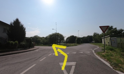
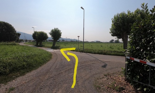
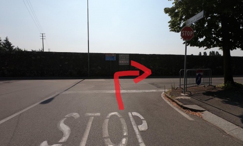
Be careful, in this area the vertical signs indicating the cycle path are wrong, follow the directions below: at the roundabout turn left (pic72) and take the underpass until you cross two roads that you go straight on (pic73) (pic74) to then finally curve to the right (pic75).
N.B. In this section you will be able to admire the marvelous Costa di Mezzate castle, located on a small promontory in the town. Built in the year 1000, it passed to the Camozzi Vertova family in 1183 and the descendants are still its owners. The castle is therefore private and can be visited only on the occasion of events organised by the tourist office of the Terre del Vescovado.
Follow the signs that lead you to the centre of the town of Costa di Mezzate, where you will see a majestic castle dominating above you (pic48) (pic49). Ride along Via Giovanni Battista Camozzi: for a few metres you will be going against the direction of traffic, so we suggest you get off the bike and accompany it by hand. When you reach the stop sign, turn left (pic50), get back on and go along a small road that goes into the countryside in the shade of the plants (via Foppe).
At the crossroads keep to the main road on the left (pic51) and on the next keep to the right (pic52) (pic53) until you cross via Colleoni where you go to the right (pic54) in the historic street between old houses, also against the direction of traffic: get off the bike for these last few metres.
When you reach the bridge over the Zerra torrent, continue straight along Via Brevi (pic55), cross the train tracks and go to the right (pic56) towards the Montello-Gorlago station, beyond which you arrive at the traffic light that crosses the SP91 leading to Sarnico.
Continue straight (pic57) and at the roundabout turn right towards Carobbio degli Angeli(pic58) keep to the main road using the short cycle path behind the power plant. Cross the bridge over the Cherio river (a branch of Lake Endine) and enter the municipality of Carobbio degli Angeli. After 200 metres turn right (pic59) towards the parish of Cicola and arrive at the traffic light further on (pic60).
Cross back over the SP91 (pic61) and the railway, go left (pic62) and take a quiet dirt road among meadows dotted with greenhouses for growing vegetables. Once arrived near a farmhouse turn left (pic63) and continue on the dirt road between the greenhouses. Then keep the left (pic64) and follow the directions. At the stop sign go right and immediately left along via Garibaldi (pic65) (pic66) in the town of Chiuduno near the sports centre. At the next stop, take the right (pic67), after the bend keep left along the dirt road (pic68) (pic69) and then past a barrier for cars, cross the road to reach the roundabout (pic70) (pic71).
Be careful, in this area the vertical signs indicating the cycle path are wrong, follow the directions below: at the roundabout turn left (pic72) and take the underpass until you cross two roads that you go straight on (pic73) (pic74) to then finally curve to the right (pic75).
N.B. In this section you will be able to admire the marvelous Costa di Mezzate castle, located on a small promontory in the town. Built in the year 1000, it passed to the Camozzi Vertova family in 1183 and the descendants are still its owners. The castle is therefore private and can be visited only on the occasion of events organised by the tourist office of the Terre del Vescovado.
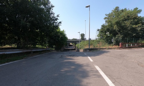
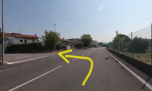
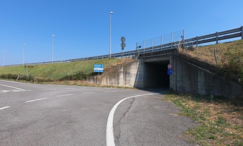

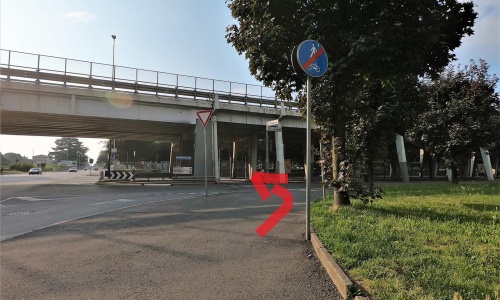
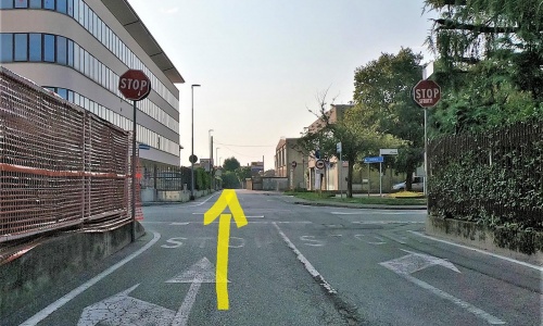
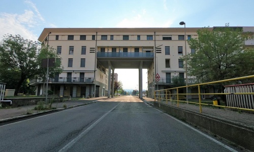
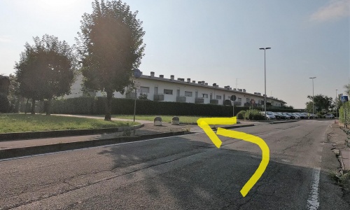
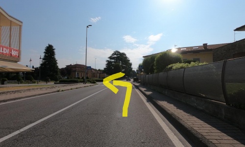
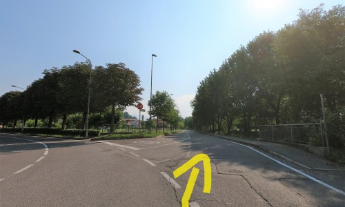
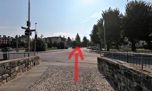
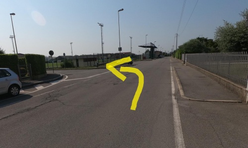
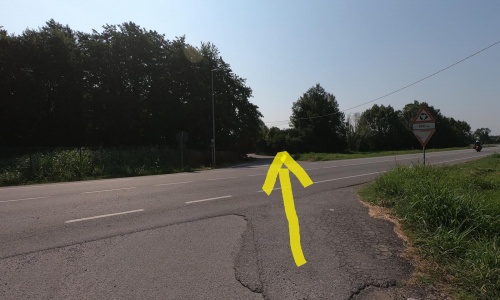
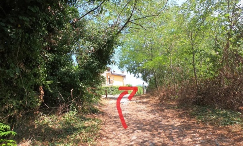
Take the underpass to cross the A4 Milan-Venice highway (pic76) (pic77), pedal to the left parallel to the highway (pic78). The road soon bends to the right and continues into a quiet area in the fields. Then turn left (pic79) where you will have to cross three streets (pic80) (pic81). At the end of the shady white road, cross an industrial area and take the second road on the left (pic82) that joins the highway exit and crosses the highway with an underpass (pic83).
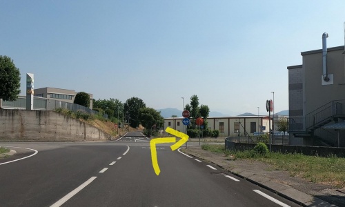
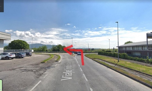
Now go right on viale Industria (pic84) to the stop sign, turn left on the provincial road for a few metres (pic85) and take the small road that goes down to the right (via Molin) (pic86).
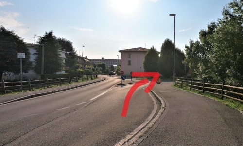
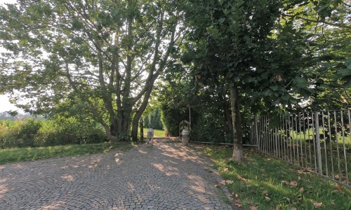
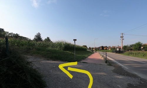
The narrow road descends towards the bed of the Oglio river and ends in the picnic area, often frequented by families on summer Sundays and near a hydroelectric power station. Now you have to take a slightly challenging ascent (pic87), but it allows you to admire wonderful views of the Oglio river and the rows of grapes of Valcalepio.
Take the underpass to cross the A4 Milan-Venice highway (pic76) (pic77), pedal to the left parallel to the highway (pic78). The road soon bends to the right and continues into a quiet area in the fields. Then turn left (pic79) where you will have to cross three streets (pic80) (pic81). At the end of the shady white road, cross an industrial area and take the second road on the left (pic82) that joins the highway exit and crosses the highway with an underpass (pic83).
Now go right on viale Industria (pic84) to the stop sign, turn left on the provincial road for a few metres (pic85) and take the small road that goes down to the right (via Molin) (pic86).
The narrow road descends towards the bed of the Oglio river and ends in the picnic area, often frequented by families on summer Sundays and near a hydroelectric power station. Now you have to take a slightly challenging ascent (pic87), but it allows you to admire wonderful views of the Oglio river and the rows of grapes of Valcalepio.
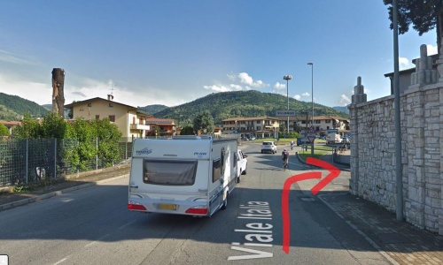
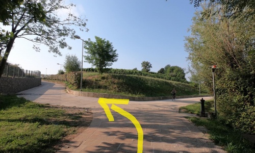
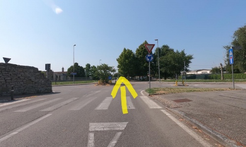
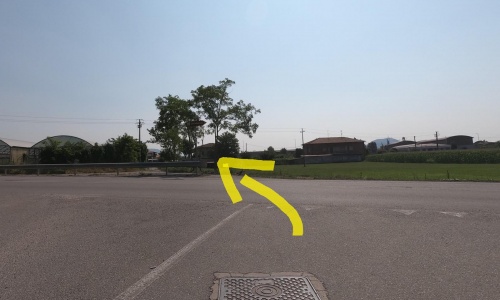
The little street reconnects to the road (pic88) that you take and go downhill to the port where you go to the left (pic89) and continue for 1 km parallel to the Oglio river which is on your right. When the road starts to go up, go right onto via Cadorna (pic90) then immediately left (pic91) along a pleasant dirt road in the fields that with ups and downs brings you to the Credaro cemetery (pic92).
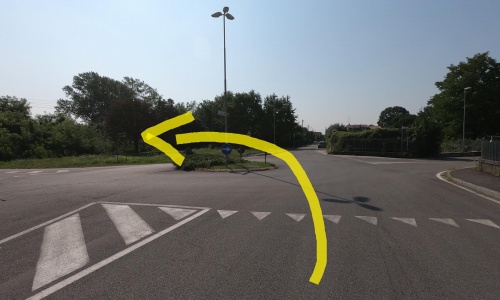
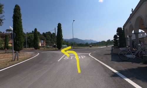
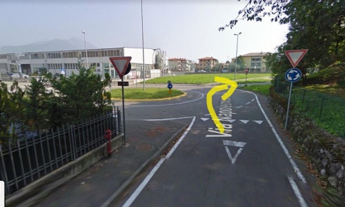
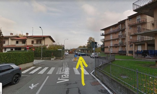
At the stop sign go left (pic93) and at the roundabout go straight on via Cesare Battisti (pic94). Get onto SP91, go right (pic95) and just before the roundabout turn right again (pic96) along via Napoleonica, passing behind some sheds, (pic97) (pic98). The road then quickly descends towards the Lake Iseo dam.
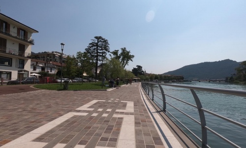
Continue straight until you reach the first houses where you go to the right to finally reach the shores of the lake (pic99) (pic100). Just a little more riding on the new lakeside promenade and you reach Piazza Venti Settembre in Sarnico where you can enjoy a delicious ice cream before you return.
The little street reconnects to the road (pic88) that you take and go downhill to the port where you go to the left (pic89) and continue for 1 km parallel to the Oglio river which is on your right. When the road starts to go up, go right onto via Cadorna (pic90) then immediately left (pic91) along a pleasant dirt road in the fields that with ups and downs brings you to the Credaro cemetery (pic92).
At the stop sign go left (pic93) and at the roundabout go straight on via Cesare Battisti (pic94). Get onto SP91, go right (pic95) and just before the roundabout turn right again (pic96) along via Napoleonica, passing behind some sheds, (pic97) (pic98). The road then quickly descends towards the Lake Iseo dam.
Continue straight until you reach the first houses where you go to the right to finally reach the shores of the lake (pic99) (pic100). Just a little more riding on the new lakeside promenade and you reach Piazza Venti Settembre in Sarnico where you can enjoy a delicious ice cream before you return.