A fascinating cycle-hiking itinerary that runs through the Bergamo island area - the area west of Bergamo bound by the Brembo and Adda Rivers - and reaches Sotto il Monte Giovanni XXIII.
Sotto il Monte Giovanni XXIII it takes its name from Angelo Giuseppe Roncalli, or Pope John XXIII, who recently became a Saint. The proposed itinerary will take you here along cycle paths and very pleasant and relaxing low-traffic roads.
The cycle route starts in Bergamo, right in Viale Giovanni XXIII. We head away from the city along some stretches of cycle path and then pedal near the hills of Bergamo. Once we’ve crossed the Brembo river on the Briolo bridge, we find ourselves on Bergamo Island.
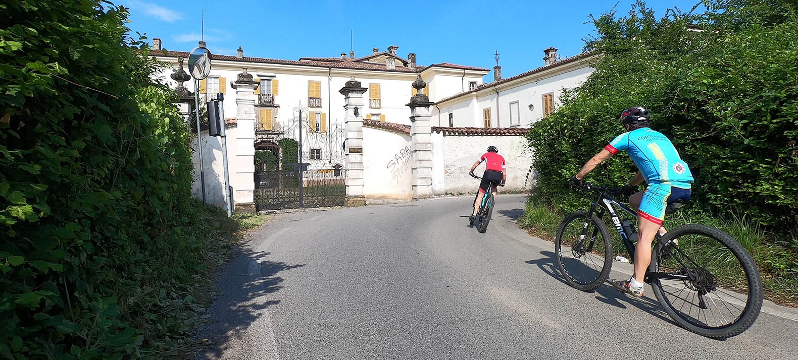
Passing through the towns of Locate and Mapello the itinerary continues close to Monte Canto in the quiet town of Pratolongo and soon reaches Sotto il Monte.
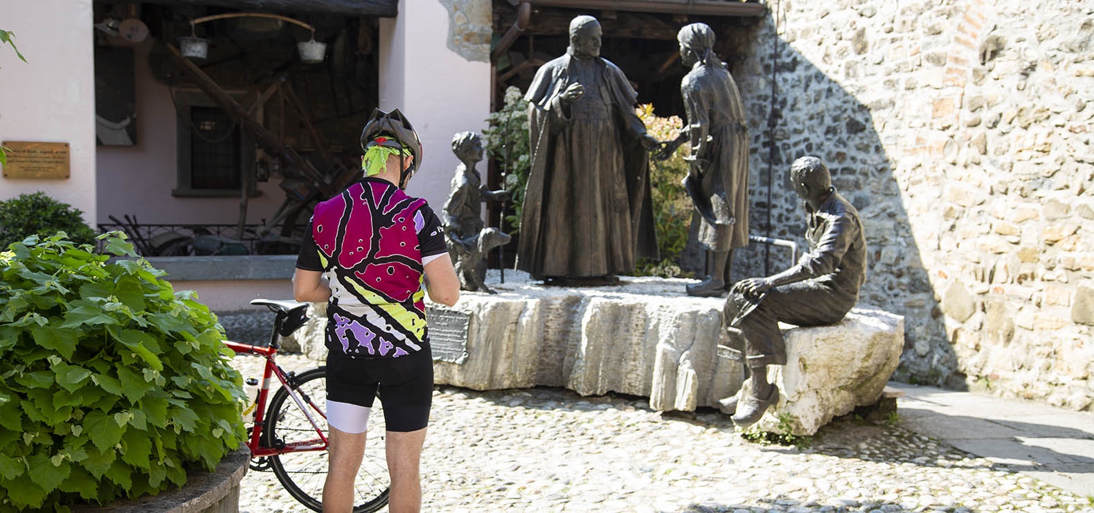
In Sotto il Monte we recommend visiting the places dear to Angelo Roncalli such as his birthplace, the Cà Maitino museum, the church of Santa Maria where he was baptised, the parish church with the Obedientia et Pax Crypt and the nearby Peace Gardens. Also, taking a short hike, you can reach the tower of San Giovanni located on the top of the hill overlooking the village.
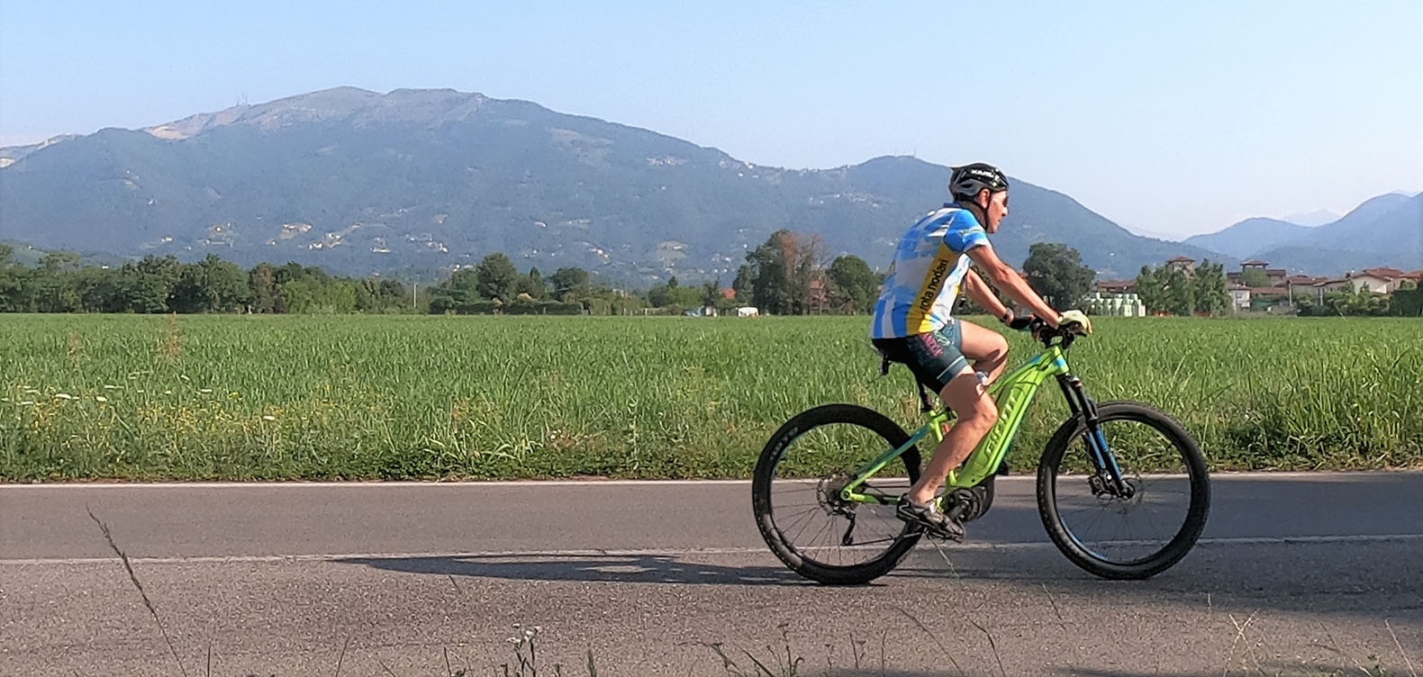
The cycle-hiking route is totally on a paved road, therefore ridable with any bike. It passes through quiet areas with little traffic but still has some stretches on the road, so we recommend the usual caution.
Route information:
Departure point: Bergamo Train Station
Arrival point: Sotto il Monte Giovanni XXIII, Piazza Mater Et Magistra
Travel time: 1.5 hours (one way)
Length: 20km
Type of path: Cycle path 15%, road with low traffic 65%, road with medium-high traffic 20%
Ground: asphalt: 100%
Total change in altitude: 200m
Minimum altitude: 224m
Maximum altitude: 321m
Practicability: All year
Suitable for: Adults who love touristic road cycling.
A fascinating cycle-hiking itinerary that runs through the Bergamo island area - the area west of Bergamo bound by the Brembo and Adda Rivers - and reaches Sotto il Monte Giovanni XXIII.
Sotto il Monte Giovanni XXIII it takes its name from Angelo Giuseppe Roncalli, or Pope John XXIII, who recently became a Saint. The proposed itinerary will take you here along cycle paths and very pleasant and relaxing low-traffic roads.
The cycle route starts in Bergamo, right in Viale Giovanni XXIII. We head away from the city along some stretches of cycle path and then pedal near the hills of Bergamo. Once we’ve crossed the Brembo river on the Briolo bridge, we find ourselves on Bergamo Island.
Passing through the towns of Locate and Mapello the itinerary continues close to Monte Canto in the quiet town of Pratolongo and soon reaches Sotto il Monte.
In Sotto il Monte we recommend visiting the places dear to Angelo Roncalli such as his birthplace, the Cà Maitino museum, the church of Santa Maria where he was baptised, the parish church with the Obedientia et Pax Crypt and the nearby Peace Gardens. Also, taking a short hike, you can reach the tower of San Giovanni located on the top of the hill overlooking the village.
The cycle-hiking route is totally on a paved road, therefore ridable with any bike. It passes through quiet areas with little traffic but still has some stretches on the road, so we recommend the usual caution.
Route information:
Departure point: Bergamo Train Station
Arrival point: Sotto il Monte Giovanni XXIII, Piazza Mater Et Magistra
Travel time: 1.5 hours (one way)
Length: 20km
Type of path: Cycle path 15%, road with low traffic 65%, road with medium-high traffic 20%
Ground: asphalt: 100%
Total change in altitude: 200m
Minimum altitude: 224m
Maximum altitude: 321m
Practicability: All year
Suitable for: Adults who love touristic road cycling.
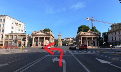
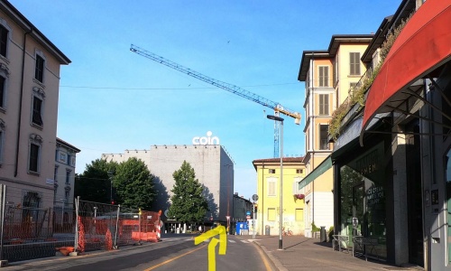
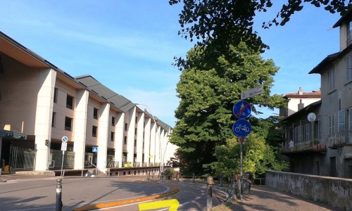
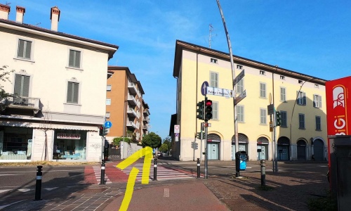
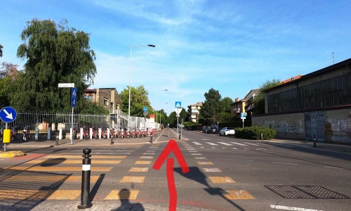
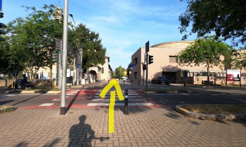
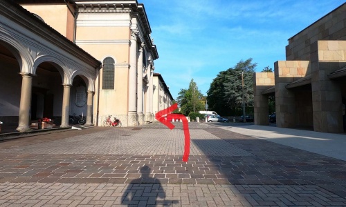

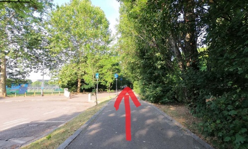
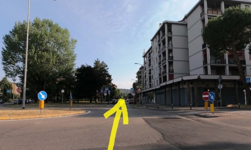
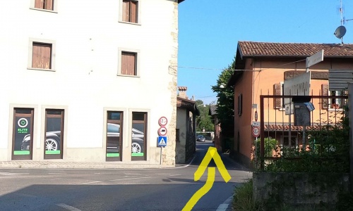
Departure from the Bergamo train station, go along viale Papa Giovanni XXIII (pic1) up to the Porta Nuova Propilei (entrance to the lower city) turn left into via Tiraboschi (pic2). Go straight on (pic3) (pic4) (pic5) until you start pedaling on the cycle path behind the large "il Triangolo" complex (pic6).
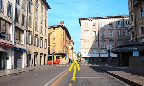
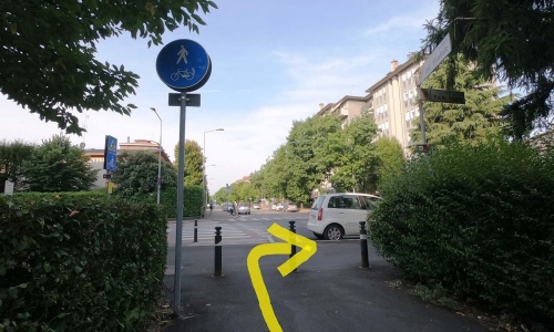
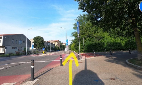
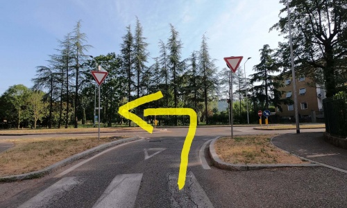
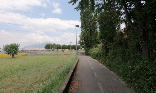
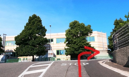
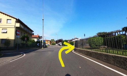
Cross via Palma il Vecchio (pic7) and continue along the cycle path that continues in a straight line in the San Paolo district (pic8) (pic9) to the parish of Loreto (pic10). Now turn right (pic11) (pic12) along the residential area of Loreto (pic13) (pic14) (pic15) (pic16) until you finally reach the Longuelo roundabout. Continue to the right (pic17) (pic18), at the stop sign go left (pic19) cross the road (pic20) and then right (pic21). When at the roundabout take the second exit (pic22) (pic23) among the condominiums.
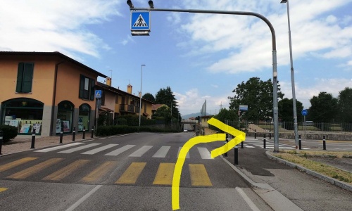
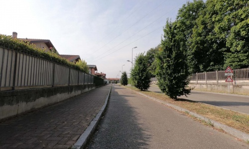
When you reach the stop sign go left along via Longuelo (pic24) alongside the golf course and after about 500 metres get back on the cycle path for a short distance (pic25) (pic26). At the nth stop sign, turn right onto Via Piatti and reach the centre of Mozzo (pic27).
Departure from the Bergamo train station, go along viale Papa Giovanni XXIII (pic1) up to the Porta Nuova Propilei (entrance to the lower city) turn left into via Tiraboschi (pic2). Go straight on (pic3) (pic4) (pic5) until you start pedaling on the cycle path behind the large "il Triangolo" complex (pic6).
Cross via Palma il Vecchio (pic7) and continue along the cycle path that continues in a straight line in the San Paolo district (pic8) (pic9) to the parish of Loreto (pic10). Now turn right (pic11) (pic12) along the residential area of Loreto (pic13) (pic14) (pic15) (pic16) until you finally reach the Longuelo roundabout. Continue to the right (pic17) (pic18), at the stop sign go left (pic19) cross the road (pic20) and then right (pic21). When at the roundabout take the second exit (pic22) (pic23) among the condominiums.
When you reach the stop sign go left along via Longuelo (pic24) alongside the golf course and after about 500 metres get back on the cycle path for a short distance (pic25) (pic26). At the nth stop sign, turn right onto Via Piatti and reach the centre of Mozzo (pic27).
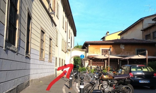
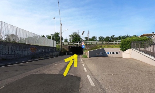
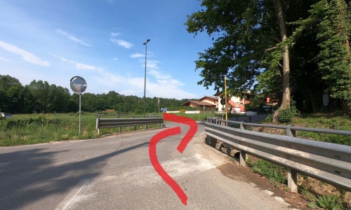
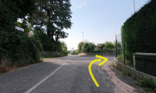
Once arrived at the church of Mozzo, turn left (pic28) and then right (pic29) (without taking the underpass) and go along the short stretch of cycle path (pic30) (pic31). Then use the next underpass (pic32) that takes you next to a supermarket and to the roundabout where you go right (pic33).
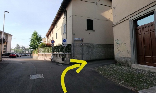
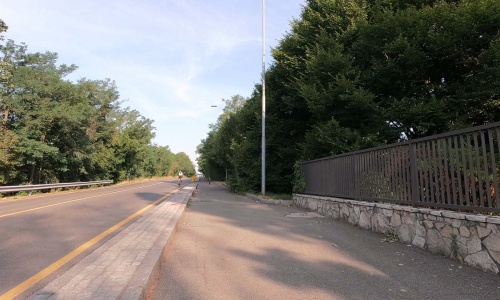
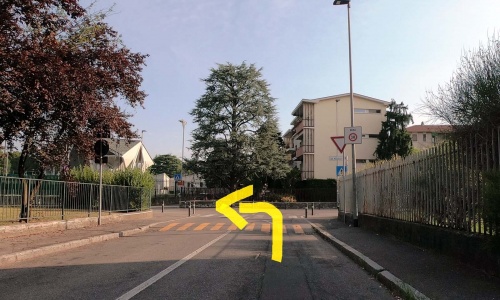
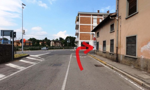
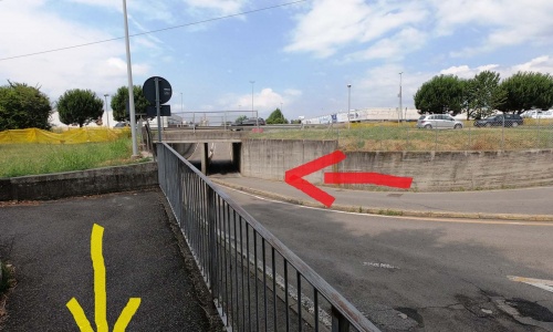
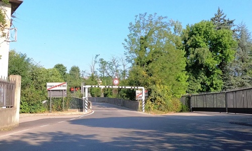
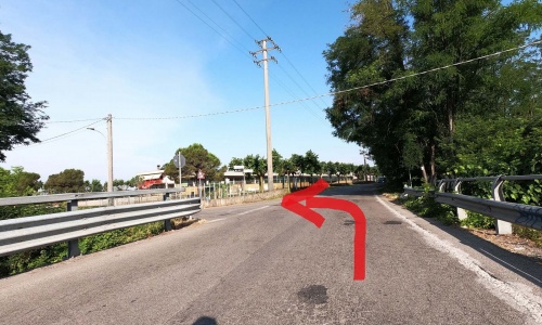
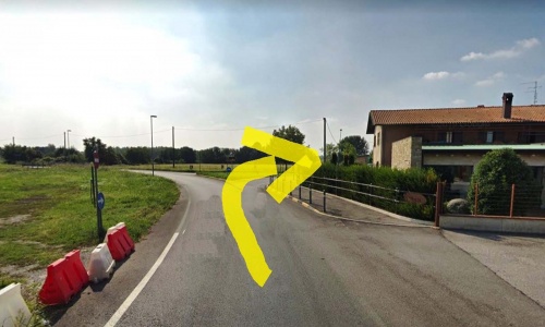
At the stop sign turn left (pic34) and descend along via Leonardo da Vinci until the deviation to the right (pic35) where you cross the Brembo river on the narrow Briolo bridge (pic36). Take a short and easy ascent, at the stop sign go left (pic37) and after the petrol station take the right onto via Malpensata (pic38).
Once arrived at the church of Mozzo, turn left (pic28) and then right (pic29) (without taking the underpass) and go along the short stretch of cycle path (pic30) (pic31). Then use the next underpass (pic32) that takes you next to a supermarket and to the roundabout where you go right (pic33).
At the stop sign turn left (pic34) and descend along via Leonardo da Vinci until the deviation to the right (pic35) where you cross the Brembo river on the narrow Briolo bridge (pic36). Take a short and easy ascent, at the stop sign go left (pic37) and after the petrol station take the right onto via Malpensata (pic38).
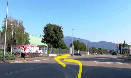
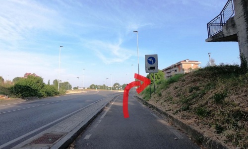
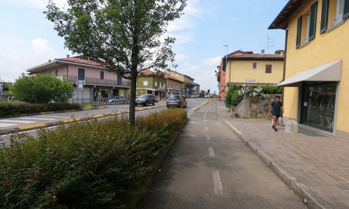
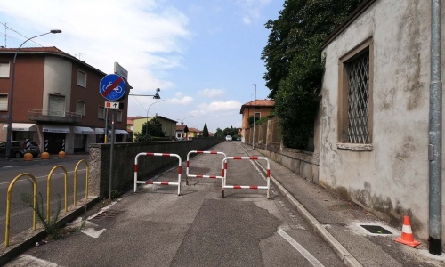
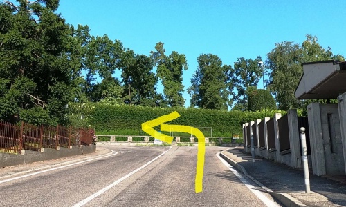
At the end of via Malpensata turn right (pic39) and immediately left (pic40) along via Caduti e dispersi dell’aeronautica at the end of which go right again and then immediately left onto via Diaz (pic41) (pic42) between the fields and some businesses.
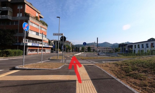
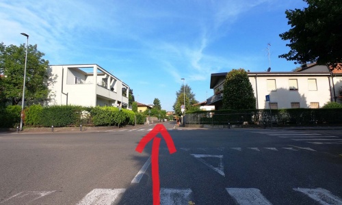
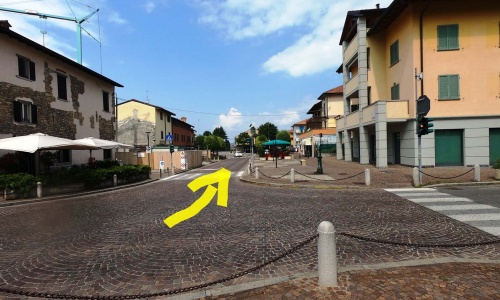
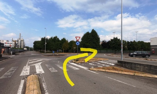
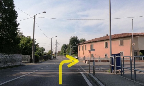
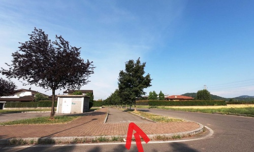
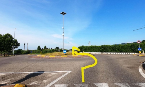
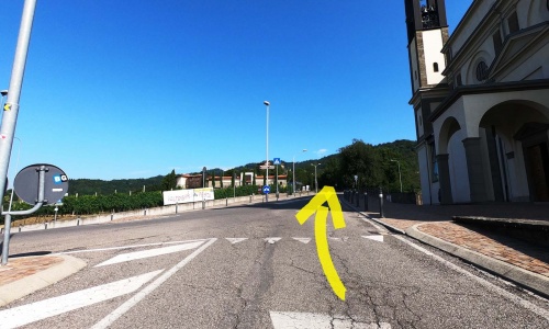
Follow an underpass that takes you to the houses in Locate (pic43), keep to the right (pic44) and then go left on the bike path (pic45) (pic46) that runs between the village and the fields. At the roundabout go to right (pic47) and ride along via Europa for 400 metres. When the street bends to the left, leave it and go to the right (pic48) and you find yourself shortly after at the roundabout in the town of Mapello. (Pic49)
In Mapello, we recommend taking a detour to visit two churches: the sanctuary of Madonna di Prada, a few metres from the roundabout, a beautiful Marian sanctuary immersed in the fields with a tree-lined street that joins the centre of the village; the second is the church of San Michele, easily visible because it is located in an elevated position on the hill and from the churchyard it is possible to admire a remarkable panorama of "Bergamo Island".
At the end of via Malpensata turn right (pic39) and immediately left (pic40) along via Caduti e dispersi dell’aeronautica at the end of which go right again and then immediately left onto via Diaz (pic41) (pic42) between the fields and some businesses.
Follow an underpass that takes you to the houses in Locate (pic43), keep to the right (pic44) and then go left on the bike path (pic45) (pic46) that runs between the village and the fields. At the roundabout go to right (pic47) and ride along via Europa for 400 metres. When the street bends to the left, leave it and go to the right (pic48) and you find yourself shortly after at the roundabout in the town of Mapello. (Pic49)
In Mapello, we recommend taking a detour to visit two churches: the sanctuary of Madonna di Prada, a few metres from the roundabout, a beautiful Marian sanctuary immersed in the fields with a tree-lined street that joins the centre of the village; the second is the church of San Michele, easily visible because it is located in an elevated position on the hill and from the churchyard it is possible to admire a remarkable panorama of "Bergamo Island".
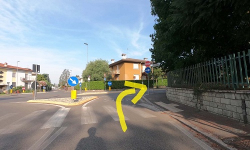
The paved road continues along the fields. Ride along the alternating one-way street that goess around Villa Gromo, a 17th century residence of the Zanchi counts, located in Valtrighe. Then going right on Via Tasso slightly uphill (pic50) passing through the towns of Piana and Botta.
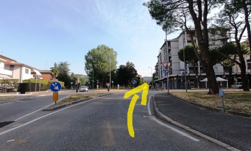
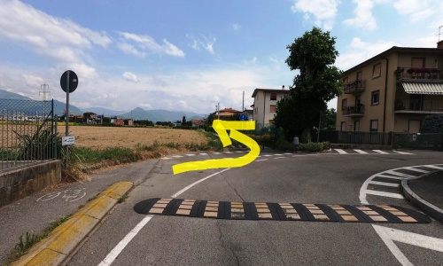
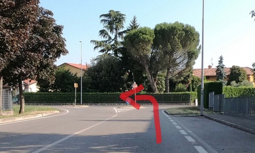
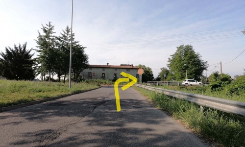
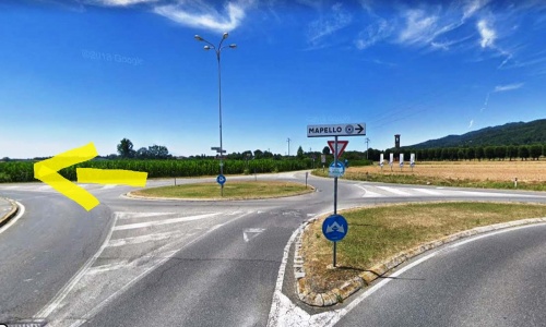
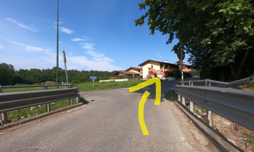
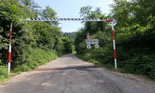
At the roundabout, do not follow the road signs for Sotto il Monte but continue slightly uphill (pic52) passing through a quiet area with some groups of houses in the woods in the Pratolongo area. At the descent go to the right (pic53) and you will soon arrive at the Sotto il Monte town square, the arrival point of the itinerary.
The paved road continues along the fields. Ride along the alternating one-way street that goess around Villa Gromo, a 17th century residence of the Zanchi counts, located in Valtrighe. Then going right on Via Tasso slightly uphill (pic50) passing through the towns of Piana and Botta.
At the roundabout, do not follow the road signs for Sotto il Monte but continue slightly uphill (pic52) passing through a quiet area with some groups of houses in the woods in the Pratolongo area. At the descent go to the right (pic53) and you will soon arrive at the Sotto il Monte town square, the arrival point of the itinerary.