
The Imagna Valley cycle path, better known as the Chitò cycle path, is a short track - about 4km - but very peculiar.
The cycle path was built on the old site of a water channel that fed the Clanezzo hydroelectric plant. This ensures that the track is almost entirely flat and that it has many grates that allow you to see the original waterway under the wheels of your bike.
The cycle path runs along the mountainside in the woods between Mount Ubione on the right and the Imagna torrent on the left. During the ride, you will be surrounded by a pristine landscape, shaded by trees and you will be able to see springs and streams.
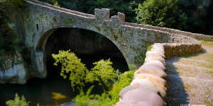
At the third kilometre, you’ll get to the Chitò bridge, an impressive hydro construction with six stone arches. The bridge is named after the engineer who designed it in 1897.
Beyond the bridge the path continues for another kilometre parallel to the SP14 provincial road and then ends at Capizzone.
The cycle path is mostly unpaved because it is almost entirely in the woods. In this section, there are also short sections on metal grates.
However, after crossing the Chitò bridge, the path becomes asphalt until the end.
N.B. On the way back, we recommend paying a visit to the Clanezzo port. It’s a charming place with a suspension bridge, ancient Venetian customs and the millennial Attone bridge.
Route information:
Departure point: Clanezzo, via Belvedere
Arrival point: Capizzone, Corso Italia 21
Travel time: 15 minutes (one way)
Length: 3.8km.
On cycle path: 95%
Ground: asphalt: 20%, dirt: 70%, grates: 10%.
Total change in altitude: 130m
Minimum altitude: 359m
Maximum altitude: 370m
Practicability: All year
Suitable for: all, up to Strozza it is entirely on the cycle path, well-kept and protected with railings.
The Imagna Valley cycle path, better known as the Chitò cycle path, is a short track - about 4km - but very peculiar.
The cycle path was built on the old site of a water channel that fed the Clanezzo hydroelectric plant. This ensures that the track is almost entirely flat and that it has many grates that allow you to see the original waterway under the wheels of your bike.
The cycle path runs along the mountainside in the woods between Mount Ubione on the right and the Imagna torrent on the left. During the ride, you will be surrounded by a pristine landscape, shaded by trees and you will be able to see springs and streams.
At the third kilometre, you’ll get to the Chitò bridge, an impressive hydro construction with six stone arches. The bridge is named after the engineer who designed it in 1897.
Beyond the bridge the path continues for another kilometre parallel to the SP14 provincial road and then ends at Capizzone.
The cycle path is mostly unpaved because it is almost entirely in the woods. In this section, there are also short sections on metal grates.
However, after crossing the Chitò bridge, the path becomes asphalt until the end.
N.B. On the way back, we recommend paying a visit to the Clanezzo port. It’s a charming place with a suspension bridge, ancient Venetian customs and the millennial Attone bridge.
Route information:
Departure point: Clanezzo, via Belvedere
Arrival point: Capizzone, Corso Italia 21
Travel time: 15 minutes (one way)
Length: 3.8km.
On cycle path: 95%
Ground: asphalt: 20%, dirt: 70%, grates: 10%.
Total change in altitude: 130m
Minimum altitude: 359m
Maximum altitude: 370m
Practicability: All year
Suitable for: all, up to Strozza it is entirely on the cycle path, well-kept and protected with railings.
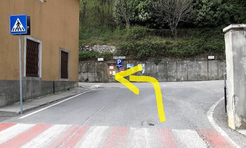
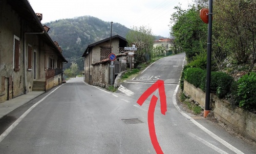
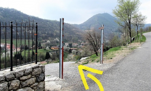
The cycle path starts from Clanezzo: a short uphill climb with two hairpin bends (via Belvedere) and the start of the path is on the left. (pic1) (pic2) (pic3)
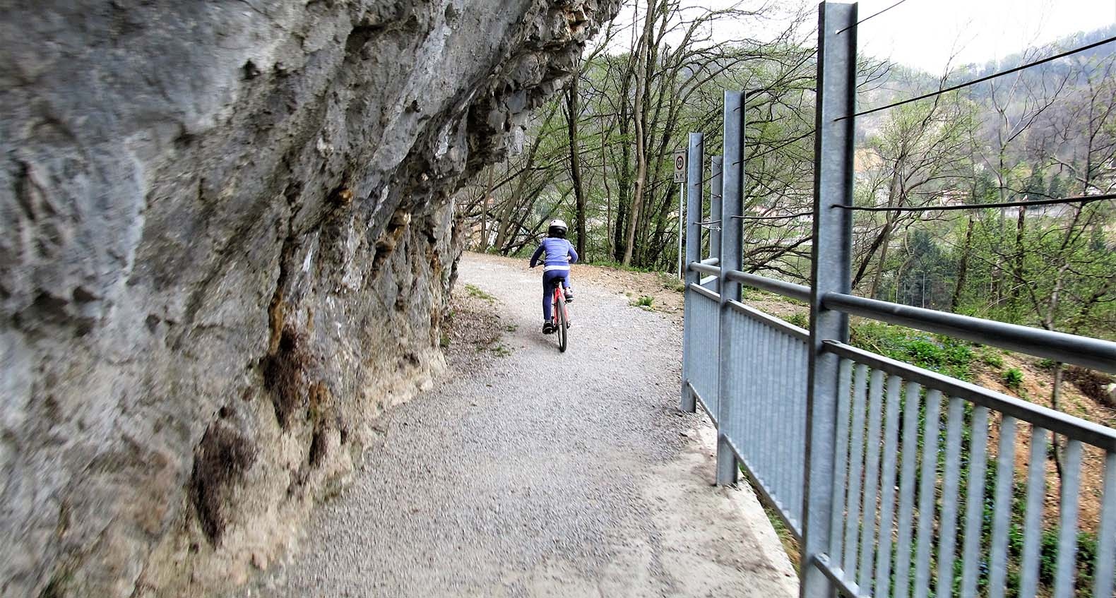
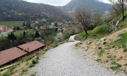
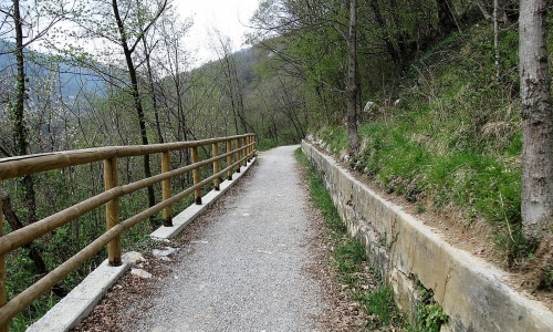
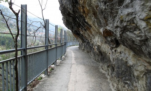
Immediately you will find a short descent (pic4) and then continue on level ground in the woods. The cycle path follows the course of the hill and with wide bends and valleys shows you beautiful views of the Imagna Valley. The route runs along wide dirt roads immersed in nature and sometimes alongside the rocks of the mountain. However, the entire track is well protected by railings (pic5) (pic6).
In this first part of the cycle path, where you will have Mount Ubione on one side and the Imagna Torrent on the other, you will come across different streams and springs, which make the route even more impressive.
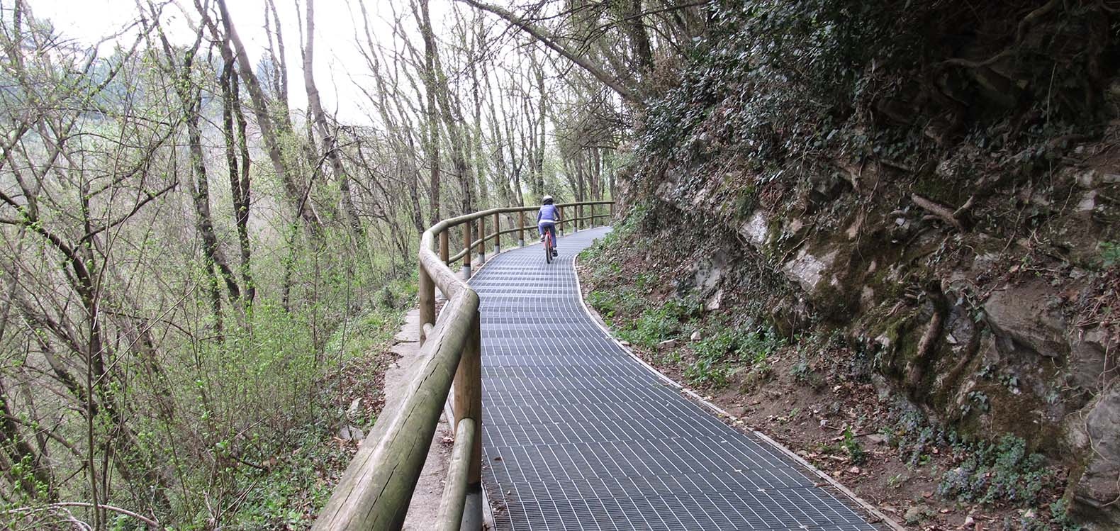
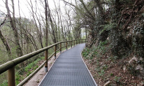
After about a kilometre from the start of the path, you will pedal on metal grates that let you see the water flowing in the remains of the old water channel (pic7).
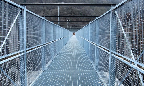
At the third kilometre, you cross the valley in the locality of Strozza along the Chitò bridge-canal of the late 1800s, consisting of six stone arches. Here the track is made up of grates and metal railings, which make it very protected and safe (pic8).
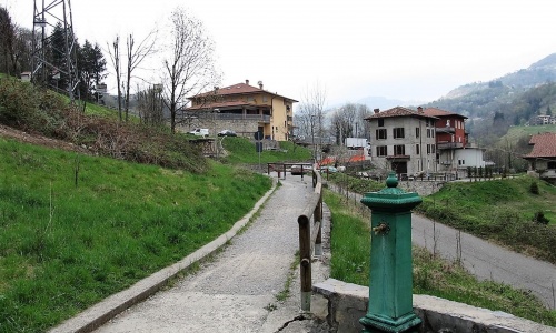
Once on the other side of the river, follow the path that runs parallel to the provincial road. After a few metres of road between the houses, finish your bike ride in Medega di Capizzone (pic9).
The cycle path starts from Clanezzo: a short uphill climb with two hairpin bends (via Belvedere) and the start of the path is on the left. (pic1) (pic2) (pic3)
Immediately you will find a short descent (pic4) and then continue on level ground in the woods. The cycle path follows the course of the hill and with wide bends and valleys shows you beautiful views of the Imagna Valley. The route runs along wide dirt roads immersed in nature and sometimes alongside the rocks of the mountain. However, the entire track is well protected by railings (pic5) (pic6).
In this first part of the cycle path, where you will have Mount Ubione on one side and the Imagna Torrent on the other, you will come across different streams and springs, which make the route even more impressive.
After about a kilometre from the start of the path, you will pedal on metal grates that let you see the water flowing in the remains of the old water channel (pic7).
At the third kilometre, you cross the valley in the locality of Strozza along the Chitò bridge-canal of the late 1800s, consisting of six stone arches. Here the track is made up of grates and metal railings, which make it very protected and safe (pic8).
Once on the other side of the river, follow the path that runs parallel to the provincial road. After a few metres of road between the houses, finish your bike ride in Medega di Capizzone (pic9).
Visitors to Ubiale, a small cluster of houses at the entrance to the Brembana Valley, often feel like they have stepped back into the Middle Ages.
One interesting example of these is the elegant bridge built by Count Attone over the River Imagna at the point where it flows into the River Brembo.
Count Attone, the last count of Lecco and Almeno, was credited not only with the design of the bridge but also the construction of Clanezzo Castle and a fortification on Mount Ubione which controlled access to the Imagna Valley.
Certain important parts of the castle survive today, including a tower. The strategic importance of the area is confirmed by the fact that a mule path ran down to the River Brembo to the place where a ferry once connected the two banks. Here, in 1925, a suspension bridge was built for workers to cross to the factories where they worked. The bridge is still in use today.
A short distance from Ubiale, at the mouth of the River Imagna, the remains of a magnificent water hammer can be found. This hammer worked iron and remained in operation until half a century ago. Although deserted, the place is extremely interesting.