The Cavallina Valley, located east of Bergamo, is a small valley that contains many naturalistic and artistic gems. It starts in Trescore Balneario, about 15km from Bergamo, a town renowned for its healing spas and frescoes by Lorenzo Lotto kept in Villa Suardi. The path ends in Endine Gaiano, a town located on the characteristic Lake Endine.
The Cherio river crosses through the valley, originating from Lake Endine and accompanies you along the Cavallina Valley cycle path. The path starts from Carobbio degli Angeli and reaches Monasterolo del Castello on the shores of the lake.
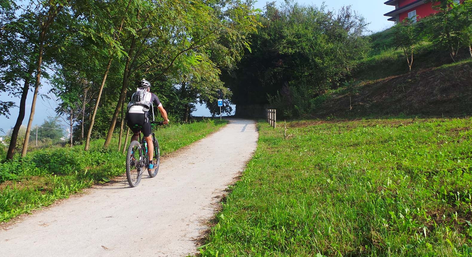
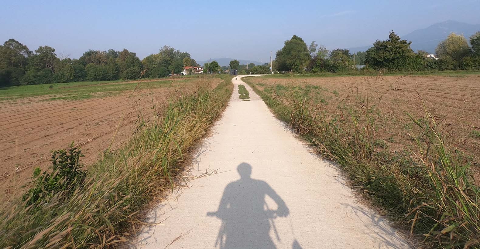
The route is very varied and relaxing on dirt roads and roads with little traffic. The Cavallina Valley cycle path was the first to be built in the province of Bergamo: the first sections date back to the 1990s.
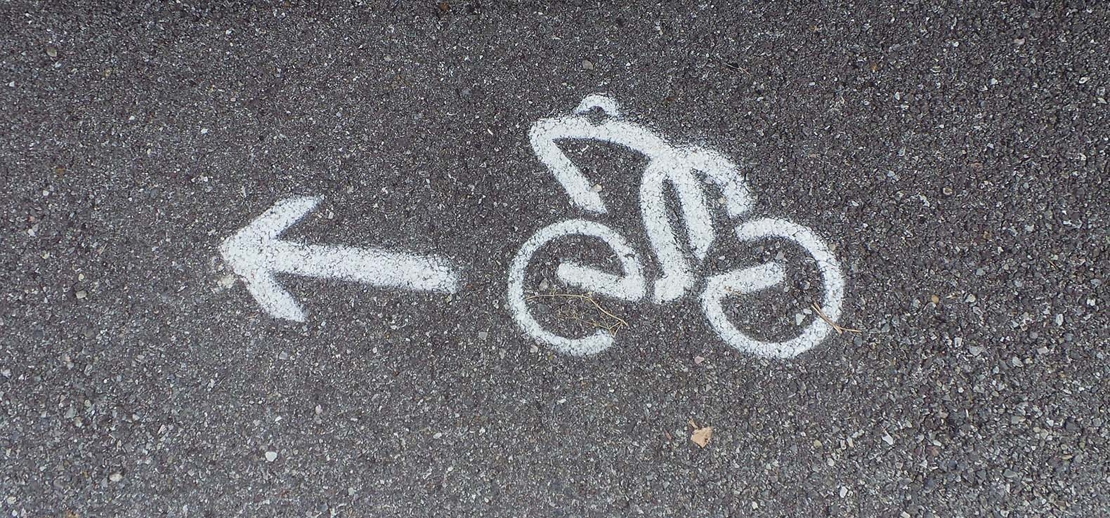
In some areas of the cycle path, the road is well signposted: signs and on the pavement (here you see the frog, symbol of the Cavallina Valley, riding a bike). In other areas, however, the cycle path isn’t as well signposted.
If you want to ride the path with children, we recommend two particularly protected and short routes, completely on the cycle path or on agricultural dirt roads. The first section, from Gorlago to Trescore, winds through the woods and between greenhouses; the second is from the Entratico roundabout to Borgo di Terzo, the dedicated bike lane runs next to the Cherio river.
Route information:
Departure point: Carobbio degli Angeli, via Mussani
Arrival point: Monasterolo del castello, Piazza
Travel time: 1.5 hours (one way)
Length: 14km
On cycle path: 50%
Ground: asphalt: 50%, cement: 20%, dirt: 30%,
Total change in altitude: 140m
Minimum altitude: 241m
Maximum altitude: 353m
Recommended bicycle: road bike with clincher, MTB, gravel and any bike suitable for riding on easy dirt roads.
Practicability: All year
Suitable for: Adults with at least a small amount of training and lovers of
cycle-hiking itineraries. Not recommended for families with children due to various stretches on the road.
The Cavallina Valley, located east of Bergamo, is a small valley that contains many naturalistic and artistic gems. It starts in Trescore Balneario, about 15km from Bergamo, a town renowned for its healing spas and frescoes by Lorenzo Lotto kept in Villa Suardi. The path ends in Endine Gaiano, a town located on the characteristic Lake Endine.
The Cherio river crosses through the valley, originating from Lake Endine and accompanies you along the Cavallina Valley cycle path. The path starts from Carobbio degli Angeli and reaches Monasterolo del Castello on the shores of the lake.
The route is very varied and relaxing on dirt roads and roads with little traffic. The Cavallina Valley cycle path was the first to be built in the province of Bergamo: the first sections date back to the 1990s.
In some areas of the cycle path, the road is well signposted: signs and on the pavement (here you see the frog, symbol of the Cavallina Valley, riding a bike). In other areas, however, the cycle path isn’t as well signposted.
If you want to ride the path with children, we recommend two particularly protected and short routes, completely on the cycle path or on agricultural dirt roads. The first section, from Gorlago to Trescore, winds through the woods and between greenhouses; the second is from the Entratico roundabout to Borgo di Terzo, the dedicated bike lane runs next to the Cherio river.
Route information:
Departure point: Carobbio degli Angeli, via Mussani
Arrival point: Monasterolo del castello, Piazza
Travel time: 1.5 hours (one way)
Length: 14km
On cycle path: 50%
Ground: asphalt: 50%, cement: 20%, dirt: 30%,
Total change in altitude: 140m
Minimum altitude: 241m
Maximum altitude: 353m
Recommended bicycle: road bike with clincher, MTB, gravel and any bike suitable for riding on easy dirt roads.
Practicability: All year
Suitable for: Adults with at least a small amount of training and lovers of
cycle-hiking itineraries. Not recommended for families with children due to various stretches on the road.
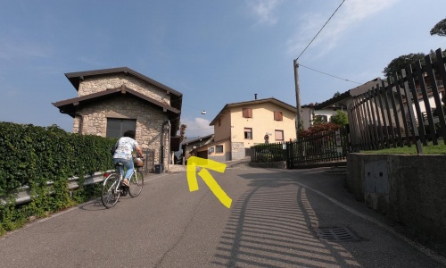
The cycle path starts in Via Mussani, in the municipality of Carobbio degli Angeli (pic1), a road easily reachable by bike from the Montello-Gorlago train station, 2.5km away.
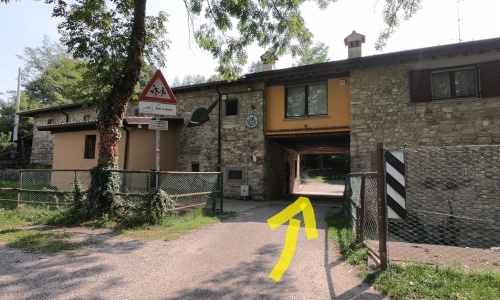
After riding along via Mussani, you find yourself on a wide path (pic2) (pic3) that leads to the Municipality of Gorlago Alpini Association’s headquarters. Pass under the portico of the building (pic4) and at the stop sign continue to the right (pic5).
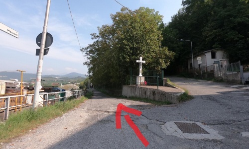
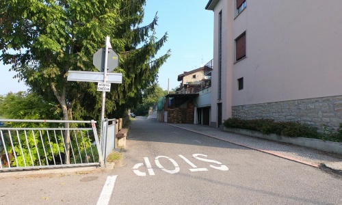
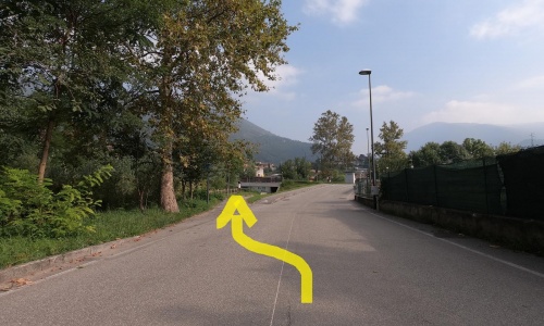
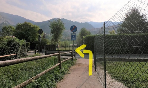
Once you reach the nearby church, turn left (pic6) and ride a few metres along via Postorre (pic7) which soon becomes a dirt road in the woods along the Cherio river.
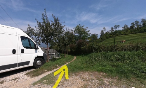
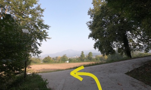
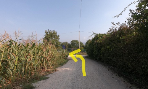
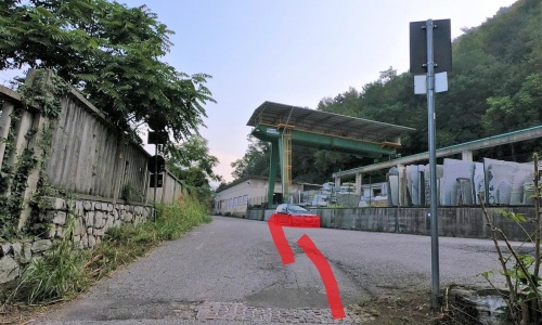
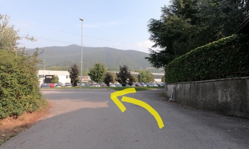
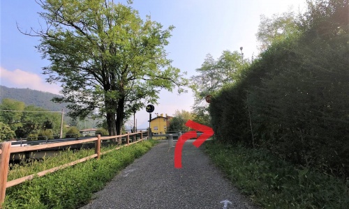
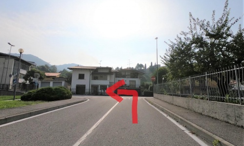
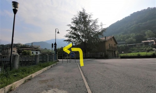
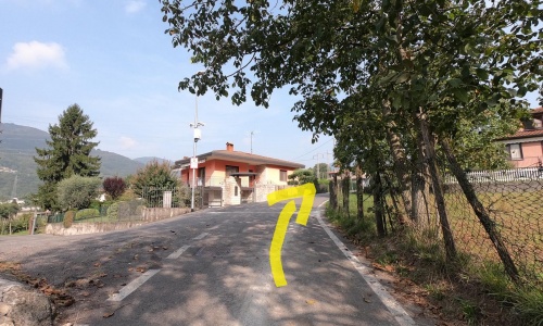
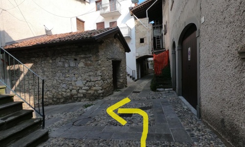
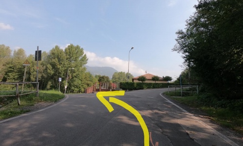
After the bridge and the short ascent, go down to the left (pic8) and then left again (pic9) and you will find yourself on a dirt road in the middle of greenhouses, where you will come across some more turns (pic10) (pic11) (pic12). After this short dirt road, you reach the provincial road that goes from Zandobbio to Trescore Balneario, but here you will notice that on the opposite side of the road the cycle path continues and is indicated by the sign (pic13) (pic14).
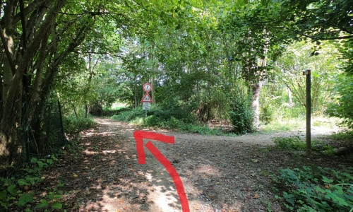
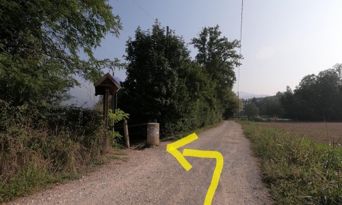
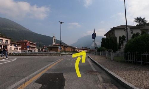
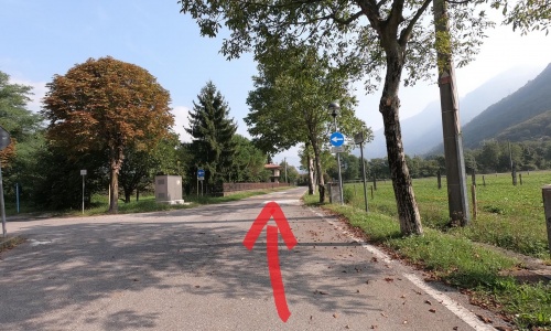
Continue between the houses (pic15) following the indications and then close to the woods (pic16) (pic17) (pic18) beneath Mount Grena, on top of which there are the remains of an ancient Roman villa. You will pass by some marble processing companies in Zandobbio (pic19) (pic20), a local and precious marble that is extracted in this area. After taking a short cycle-pedestrian section (pic21), turn left (pic22) and then right (pic23)to return to the signposted section of the Cavallina Valley cycle path.
The cycle path starts in Via Mussani, in the municipality of Carobbio degli Angeli (pic1), a road easily reachable by bike from the Montello-Gorlago train station, 2.5km away.
After riding along via Mussani, you find yourself on a wide path (pic2) (pic3) that leads to the Municipality of Gorlago Alpini Association’s headquarters. Pass under the portico of the building (pic4) and at the stop sign continue to the right (pic5).
Once you reach the nearby church, turn left (pic6) and ride a few metres along via Postorre (pic7) which soon becomes a dirt road in the woods along the Cherio river.
After the bridge and the short ascent, go down to the left (pic8) and then left again (pic9) and you will find yourself on a dirt road in the middle of greenhouses, where you will come across some more turns (pic10) (pic11) (pic12). After this short dirt road, you reach the provincial road that goes from Zandobbio to Trescore Balneario, but here you will notice that on the opposite side of the road the cycle path continues and is indicated by the sign (pic13) (pic14).
Continue between the houses (pic15) following the indications and then close to the woods (pic16) (pic17) (pic18) beneath Mount Grena, on top of which there are the remains of an ancient Roman villa. You will pass by some marble processing companies in Zandobbio (pic19) (pic20), a local and precious marble that is extracted in this area. After taking a short cycle-pedestrian section (pic21), turn left (pic22) and then right (pic23)to return to the signposted section of the Cavallina Valley cycle path.
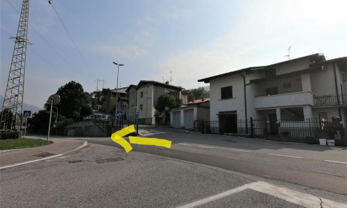
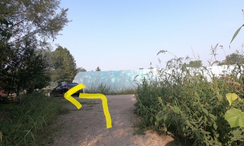
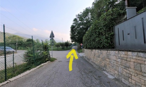
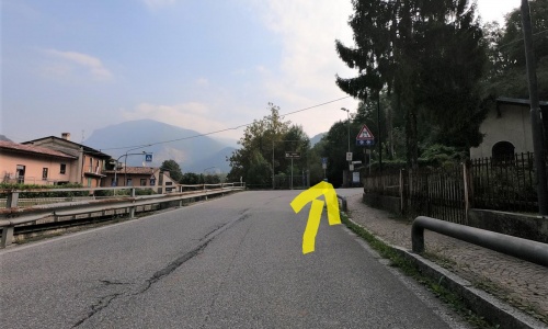
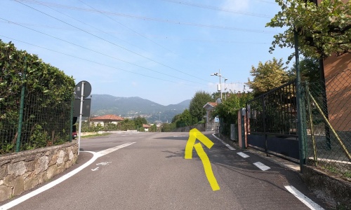
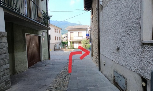
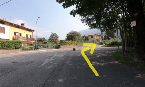
The red paved track runs beside the Cherio river and then turns right (pic24) and continues between the houses (pic25) (pic26) (pic27). At the stop sign, turn left (pic28) (pic29) and, a little further on, resume pedalling on the path that is indicated on the right (pic30).
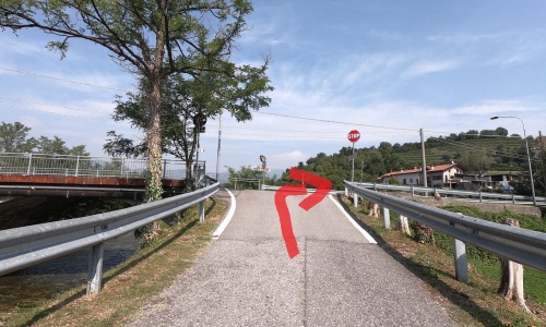
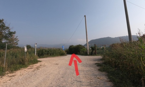
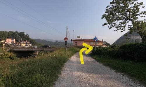
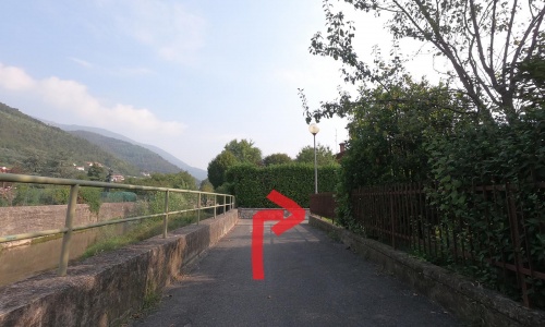
Reach a small bridge (pic31) and, after crossing it, go along the road for 100 metres until you enter a cycle-pedestrian underpass (pic32). At the end turn left (pic33) to reach the village of Borgo di Terzo.
The red paved track runs beside the Cherio river and then turns right (pic24) and continues between the houses (pic25) (pic26) (pic27). At the stop sign, turn left (pic28) (pic29) and, a little further on, resume pedalling on the path that is indicated on the right (pic30).
Reach a small bridge (pic31) and, after crossing it, go along the road for 100 metres until you enter a cycle-pedestrian underpass (pic32). At the end turn left (pic33) to reach the village of Borgo di Terzo.
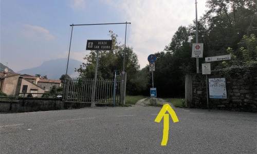
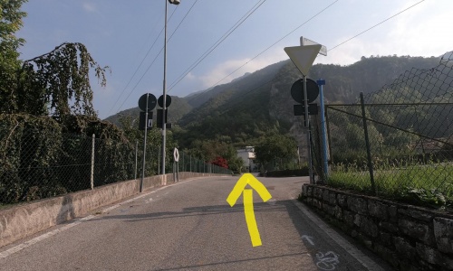
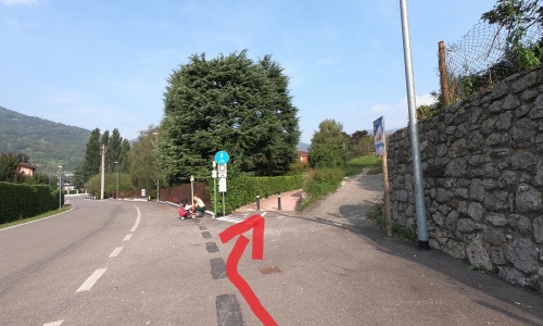
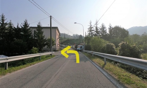
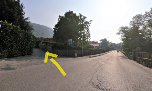
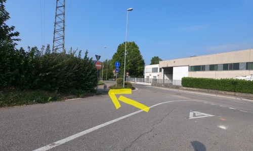
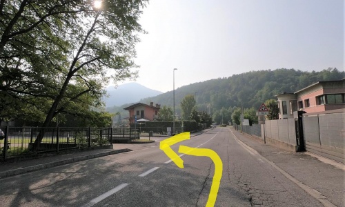
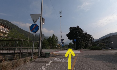
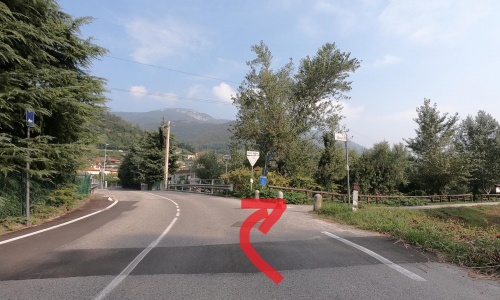
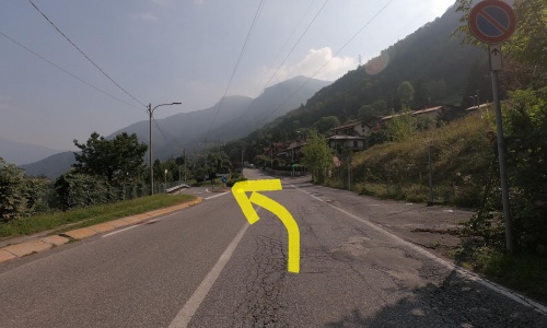
Ride a few metres uphill on the road leading to Berzo San Fermo (pic34) and at the hairpin bend on Via Bergamo, take a small road in front of you instead (pic35) (pic36). You will be on a cemented stretch between the Tonale state road 42 and the Cherio river. At the end take the ascent to the Colli di San Fermo (pic37) and, after only 300 metres, leave it to turn left (pic38).
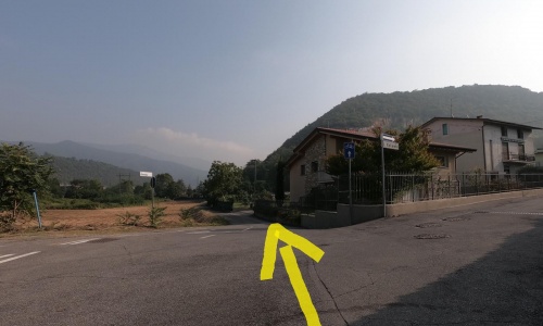
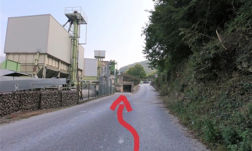
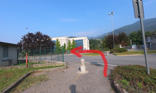
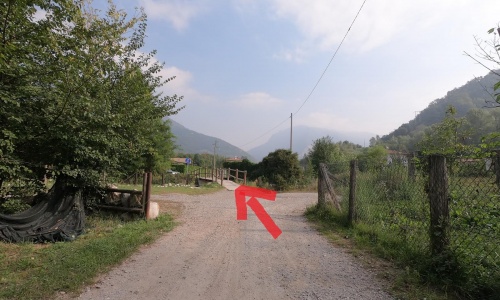
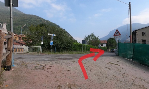
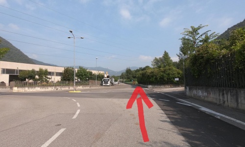
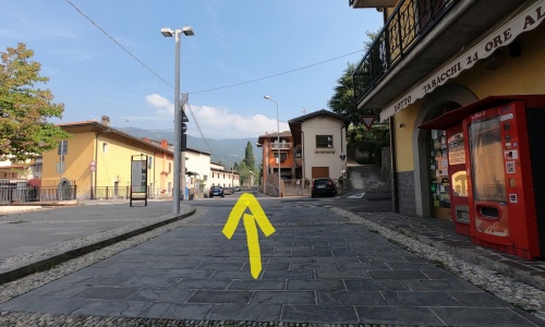
Ride again beside the Cherio river (pic39), continue to the left (pic40). Once past the industrial zone (pic41) (pic42) (pic43), take a short ascent and a cycle-pedestrian section (pic44) (pic45) and then enter the old centre of Casazza (pic47), a very neat and beautiful historic village. Here, get off and walk your bike a few metres between the houses and paved streets often frequented by children playing on the street (pic48) (pic49).
Ride a few metres uphill on the road leading to Berzo San Fermo (pic34) and at the hairpin bend on Via Bergamo, take a small road in front of you instead (pic35) (pic36). You will be on a cemented stretch between the Tonale state road 42 and the Cherio river. At the end take the ascent to the Colli di San Fermo (pic37) and, after only 300 metres, leave it to turn left (pic38).
Ride again beside the Cherio river (pic39), continue to the left (pic40). Once past the industrial zone (pic41) (pic42) (pic43), take a short ascent and a cycle-pedestrian section (pic44) (pic45) and then enter the old centre of Casazza (pic47), a very neat and beautiful historic village. Here, get off and walk your bike a few metres between the houses and paved streets often frequented by children playing on the street (pic48) (pic49).
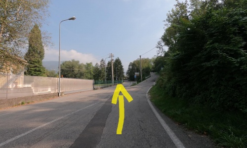
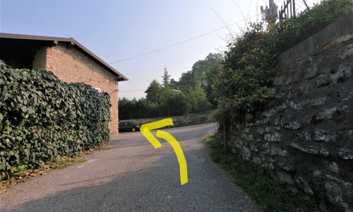
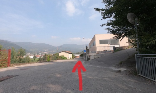
Beyond the inhabited centre continue straight on via Piave, ignoring all the deviations, (pic50) (pic51) (pic52) (pic53) along a relaxing road between the houses and meadows until you reach the end of the cycle path.
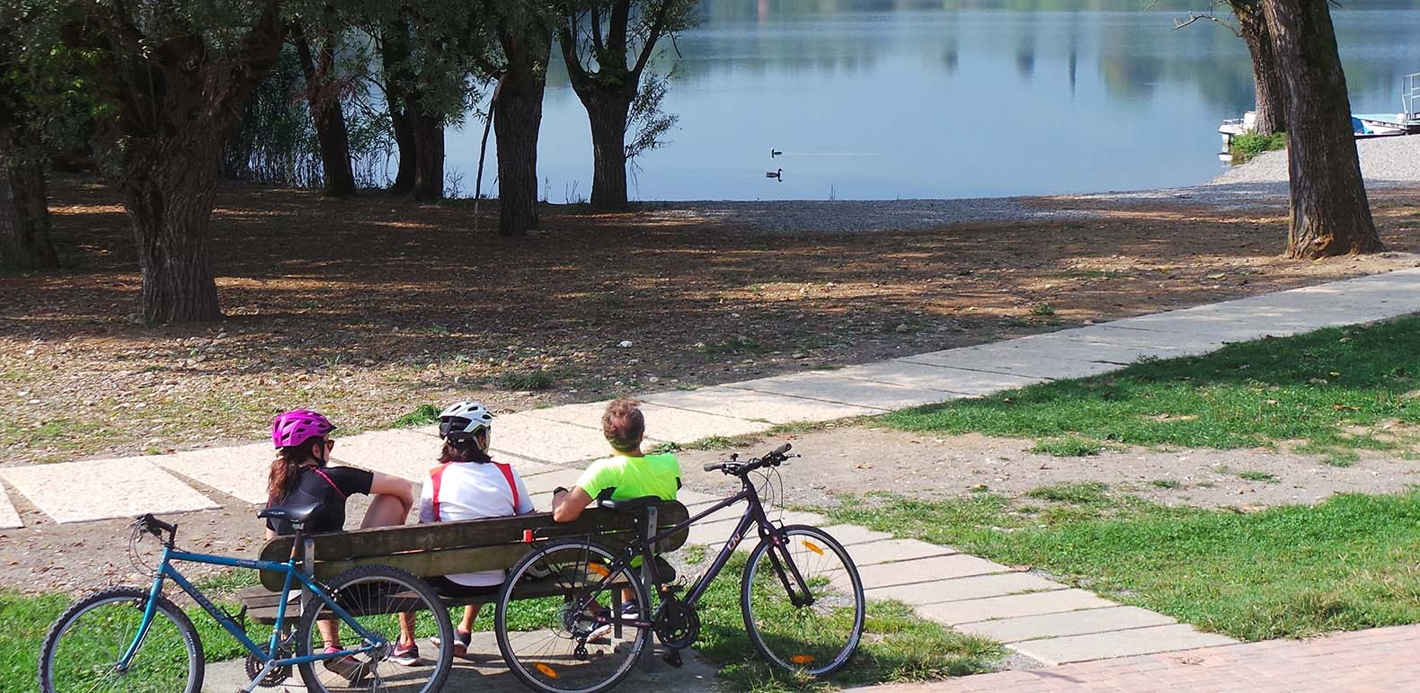
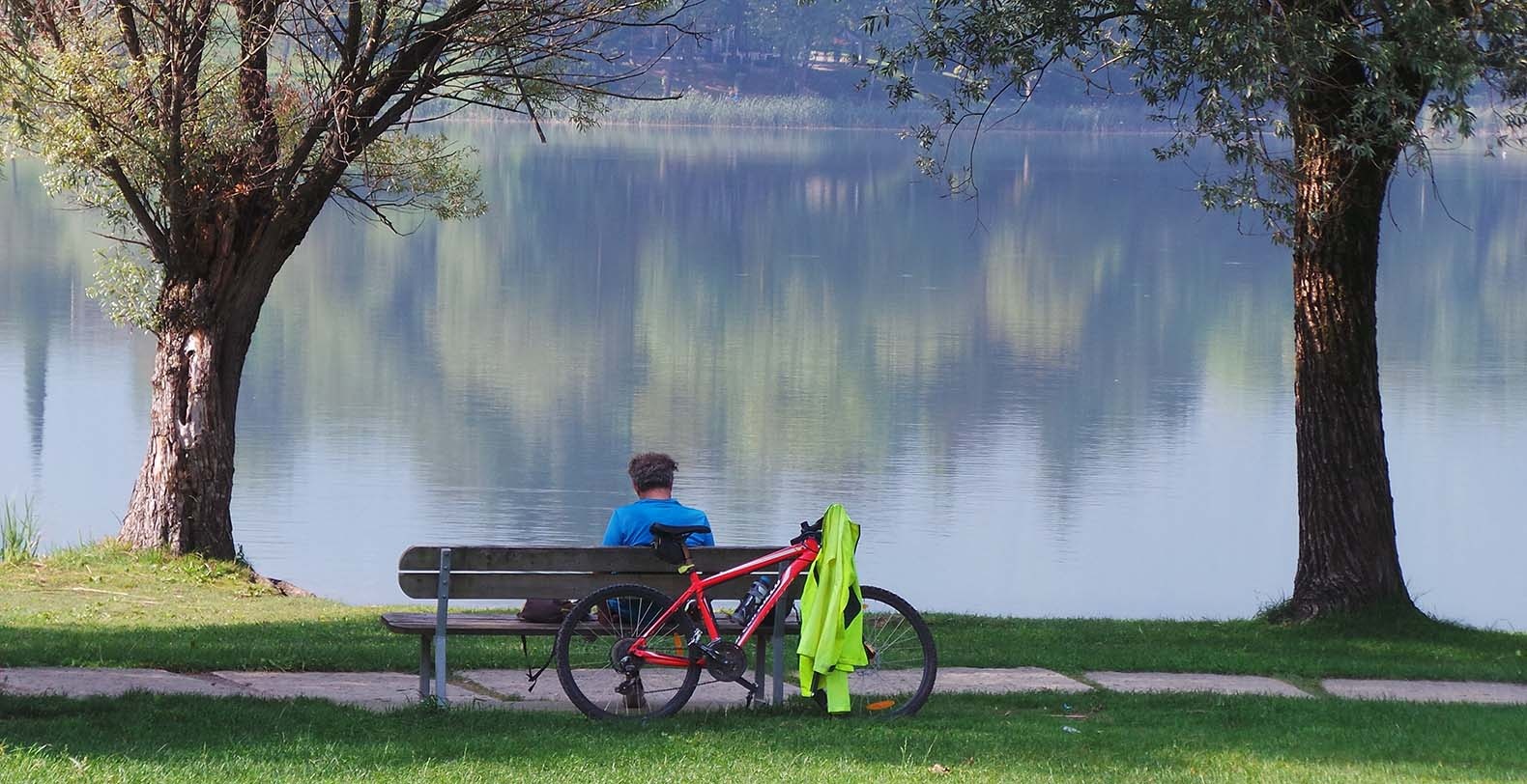
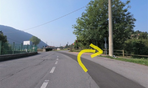
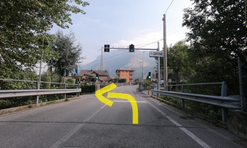
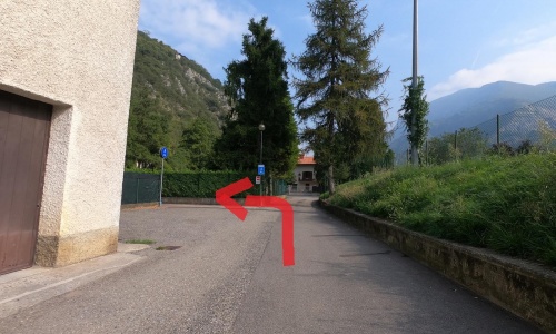
It is definitely recommended to continue for a few kilometres to reach Lake Endine. Then continue to the right (pic54) on the road for a few hundred metres, then left to via Monte Grappa (pic55) and reach the lakefront area where you can relax before returning.
If you want, from this point, you can take the 18km ring route on the road around the lake.
Beyond the inhabited centre continue straight on via Piave, ignoring all the deviations, (pic50) (pic51) (pic52) (pic53) along a relaxing road between the houses and meadows until you reach the end of the cycle path.
It is definitely recommended to continue for a few kilometres to reach Lake Endine. Then continue to the right (pic54) on the road for a few hundred metres, then left to via Monte Grappa (pic55) and reach the lakefront area where you can relax before returning.
If you want, from this point, you can take the 18km ring route on the road around the lake.
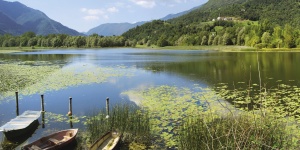
Lake Endine is a small yet beautiful jewel: its 14 kilometers-long shores are crossed by rushing creeks going down from the surrounding mountains.
The natural environment hasn’t changed much over the time, to the extent that it became an area protected by Lombardy Region: the green landscape is just breath-taking!
Canebrakes, shores, meadows: a mosaic of enchanting places you can visit going on foot or by bike.
Just a few kilometers North-East from here there is an amazing surprise, as well: another terrific small lake, called Gaiano.
In the summertime you can practice many sports such as sailing, windsurfing, canoeing, rowing and fishing.